OUTBACK WORKSHOP 3
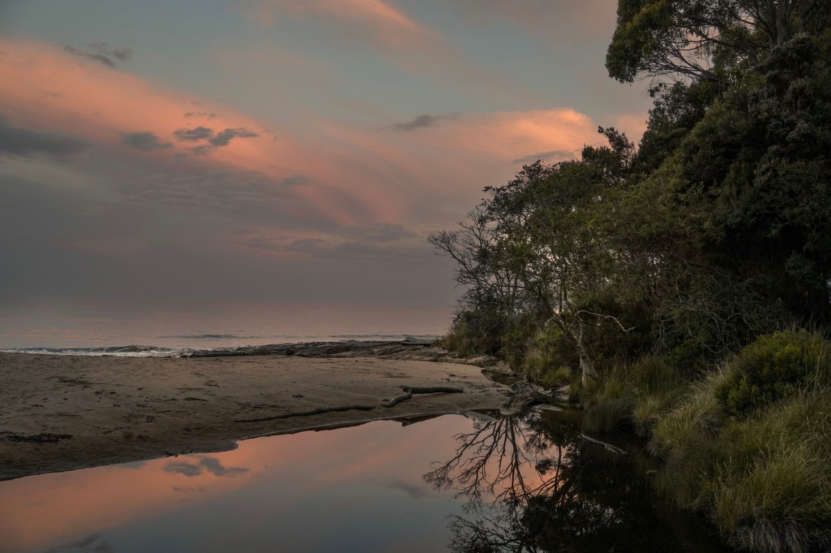
It was interesting to see the landscape change as we headed west from Katherine.
The sparse savannah of the Northern Territory gave way to dramatic escarpments and weird vegetation as the West Australian boarder approached.
Boab Trees and Kapoks take over and spear grass is replaced by Cane grass.
Roadhouses are few and far between and the cost of diesel climbs as the distance from major centers increases. It appears there have been big changes at Victoria River roadhouse.
Temperatures were creeping up into the 40’s so we found a big sandstone overhang, just out of Kununurra and settled down in the shade for a morning painting.
We flew to the Bungle Bungles the previous day and walked into Cathedral gorge. Because of weight restrictions, we couldn’t take painting gear. This spot, close to Kununurra, offered similar rockforms and was only 10 minutes from town.
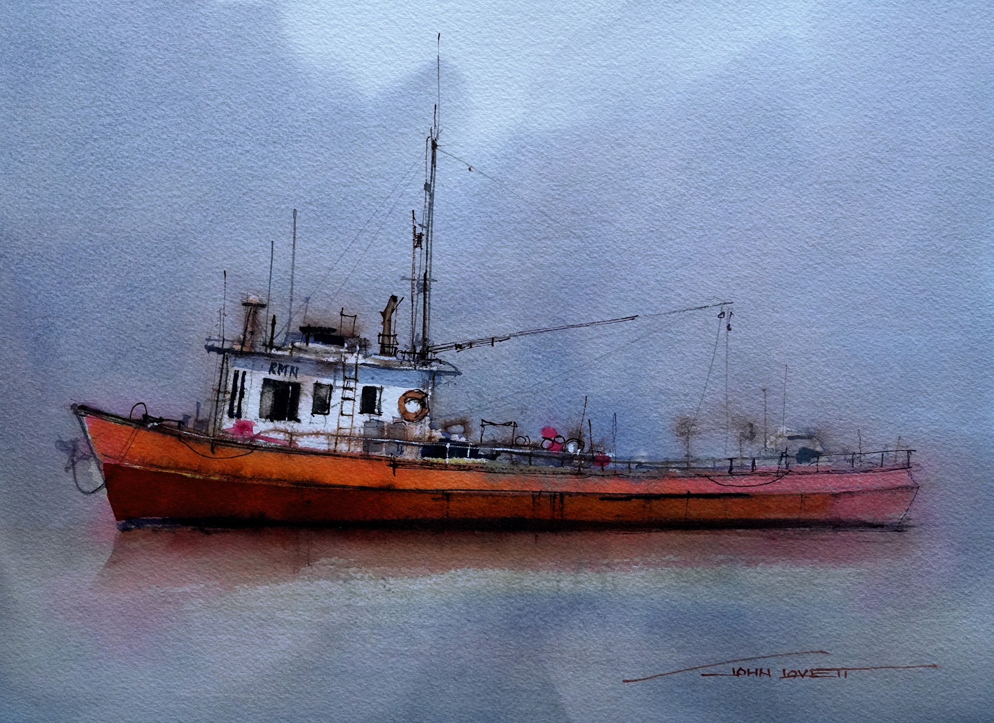
I love the contrast between transparent watercolour and flat, opaque gouache. I also used Burnt Sienna Ink and a sepia pastel pencil on this demonstration.
We left Kununurra by coach and headed down the Gibb River Road to El Questro. Being the end of the Dry, all roads were open. During the wet they can all be closed.
The landscape here is magnificent. The time to see it is just after sunrise and just before sunset. The middle of the day is hot and the light is flat and overhead.
On El Questro Station are Zebedee springs. They are a series of thermal pools, tucked under an escarpment and jammed full of beautiful Livingstonia Palms. We spent a while swimming there, but had to be out by midday. Guests from the Homestead (paying $3,000 a day) are then ushered in to relax without the distraction of folks paying less.
El Questro’s airstrip is a busy place. When we arrived there were a dozen small planes lined up.
Another impressive feature of El Questro is Chamberlain Gorge. We did a boat cruise up the gorge and were amazed at it size.
The Gorge is full of archer fish, Catfish,and Barramundi.
These two Barra were around a metre long.
Archer fish archering. I have never seen it before, except on telly. Thanks to a 12 shots per second frame rate, managed to get a photo of one. They can squirt water a couple of metres with pinpoint accuracy.
Our coach made a couple of unsuccessful attempts to climb the steep dusty track out of Chamberlain Gorge. Finally, with a long run up and no passengers it made it out.
…we were left to walk.
Our accommodation at El Questro were interesting, triple skinned tents with timber floors. Designed for the tropics, but struggling to cope with 40 plus temperatures.
The air-conditioned option is “The Homestead” but at $3000/night, a bit expensive!
Emma Gorge, where we stayed on El Questro, is a great walk and early morning swim.
Our last painting day with the workshop was at, or in, the Pentacost river behind El Questro township.
We started out packed into the shade of a large paperbark, but soon spread out into the river.
An endless supply of clean, cool water
The cattle couldn’t quiet figure out what was going on.
Farewell dinner at the Emma Gorge restaurant with the roof open.
KUNANURRA, EL QUESTRO

It was interesting to see the landscape change as we headed west from Katherine.

The sparse savannah of the Northern Territory gave way to dramatic escarpments and weird vegetation as the West Australian boarder approached.

Boab Trees and Kapoks take over and spear grass is replaced by cane grass
.
 .
.
Roadhouses are few and far between and the cost of diesel climbs as the distance from major centers increases. It appears there have been big changes at Victoria River roadhouse.
.

Temperatures were creeping up into the 40’s so we found a big sandstone overhang, just out of Kununurra and settled down in the shade for a morning painting.

We flew to the Bungle Bungles the previous day and walked into Cathedral gorge. Because of weight restrictions, we couldn’t take painting gear. This spot, close to Kununurra, offered similar rockforms and was only 10 minutes from town.

I love the contrast between transparent watercolour and flat, opaque gouache. I also used Burnt Sienna Ink and a sepia pastel pencil on this demonstration.
.

We left Kununurra by coach and headed down the Gibb River Road to El Questro. Being the end of the Dry, all roads were open. During the wet they can all be closed.
.

The landscape here is magnificent. The time to see it is just after sunrise and just before sunset. The middle of the day is hot and the light is flat and overhead.
.

On El Questro Station are the Zebedee springs. They are a series of thermal pools, tucked under an escarpment and jammed full of beautiful Livistona Palms. We spent a while swimming there, but had to be out by midday. Guests from the Homestead (paying $3,000 a day) are then ushered in to relax without the distraction of folks paying less.
.

El Questro’s airstrip is a busy place. When we arrived there were a dozen small planes lined up.
.

Another impressive feature of El Questro is Chamberlain Gorge. We did a boat cruise up the gorge and were amazed at it size.


The Gorge is full of archer fish, Catfish,and Barramundi.

These two Barra were around a metre long.

Archer fish archering.
I have never seen it before, except on telly. Thanks to a 12 shots per second frame rate, I managed to get a photo of one. They can squirt water a couple of metres with pinpoint accuracy.
.

Our coach made a couple of unsuccessful attempts to climb the steep dusty track out of Chamberlain Gorge. Finally, with a long run up and no passengers, it made it out.

…we were left to walk.
.

Our accommodation at El Questro were interesting, triple skinned tents with timber floors. Designed for the tropics, but struggling to cope with 40 plus temperatures.

The air-conditioned option is “The Homestead” but at $3000/night, a bit expensive!
.
Emma Gorge is where we stayed on El Questro. It is a great walk and early morning swim.


.
Our last painting day with the workshop was at, or in, the Pentacost river behind El Questro township.

We started out packed into the shadow of a large paperbark, but soon spread out into the river.


An endless supply of clean, cool water

The cattle couldn’t quiet figure out what was going on.
.

Farewell dinner at the Emma Gorge restaurant with the roof open.