LONG DUSTY ROADS

All Text and Images © John Lovett 2019

After 660 kms of dusty corrugations down the Gibb River Road, we enjoyed a brief stretch of bitumen across to Halls Creek. An overnight stop and we were off down the Tanami Road to Alice Springs. The Tanami Road is 1100kms of mostly well graded dirt with some patches of bulldust and rough corrugations. The Aboriginal Communities of Billiluna and Yuendumu sell expensive diesel.

After stocking up in Alice Springs, we spent a couple of days in the Eastern MacDonnell’s before heading East along the Plenty Highway – a long strip of corrugated dirt that cuts straight across the Northern Territory into Queensland

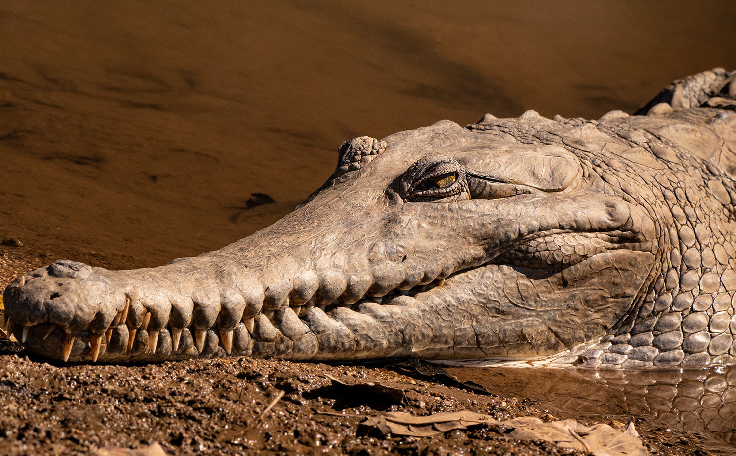
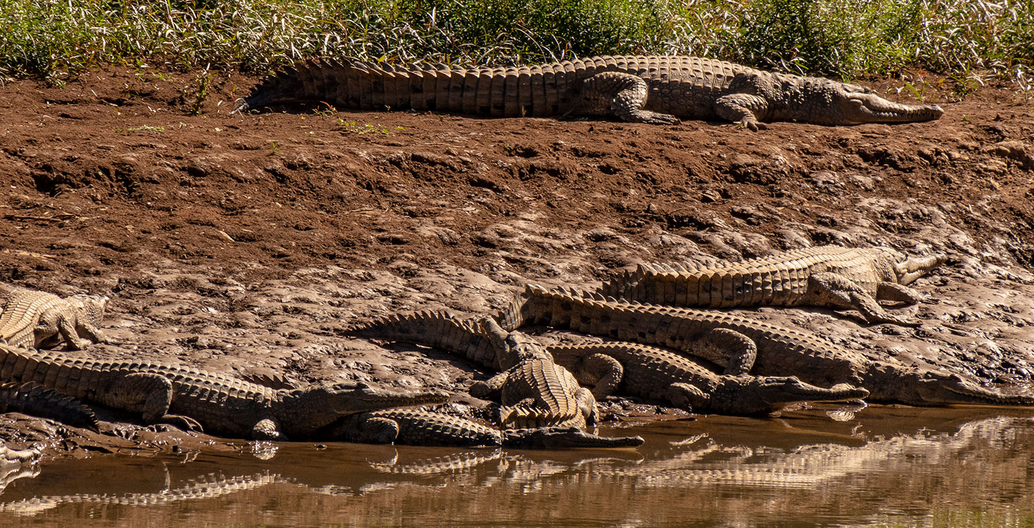
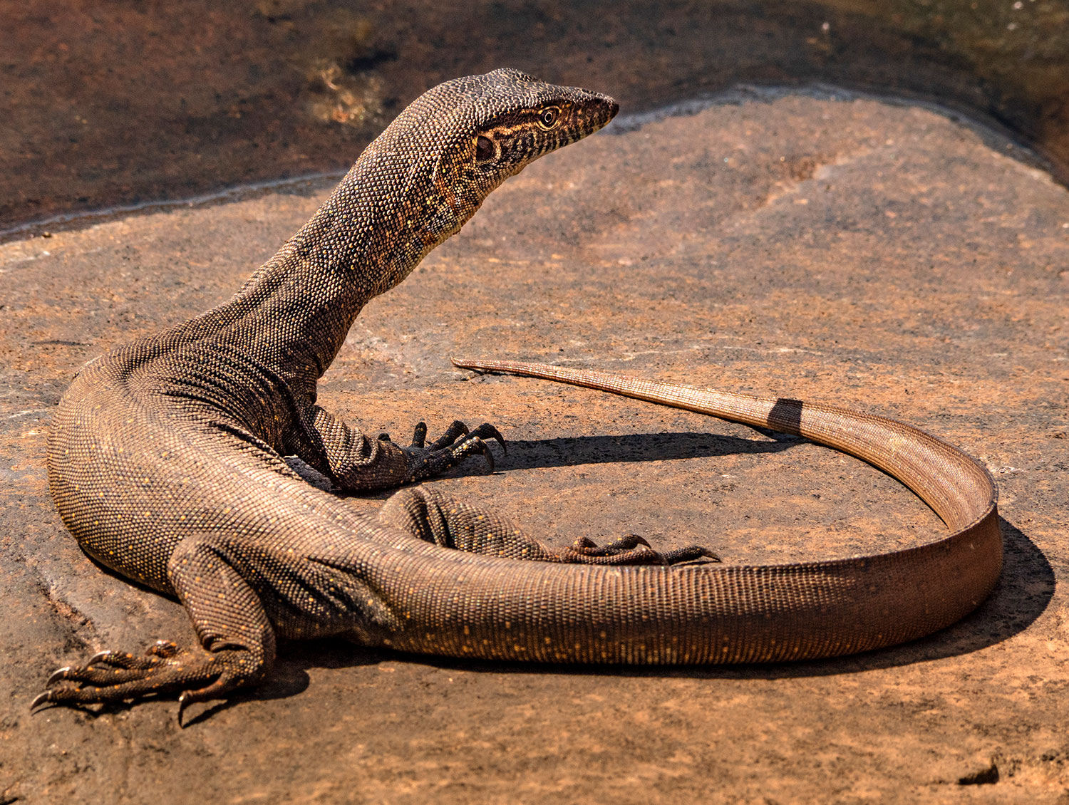
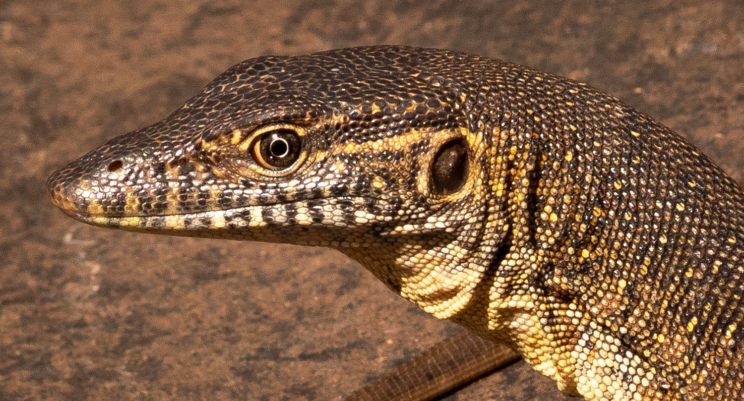
Freshwater Crocs are thriving at (an almost dry) Windjana Gorge

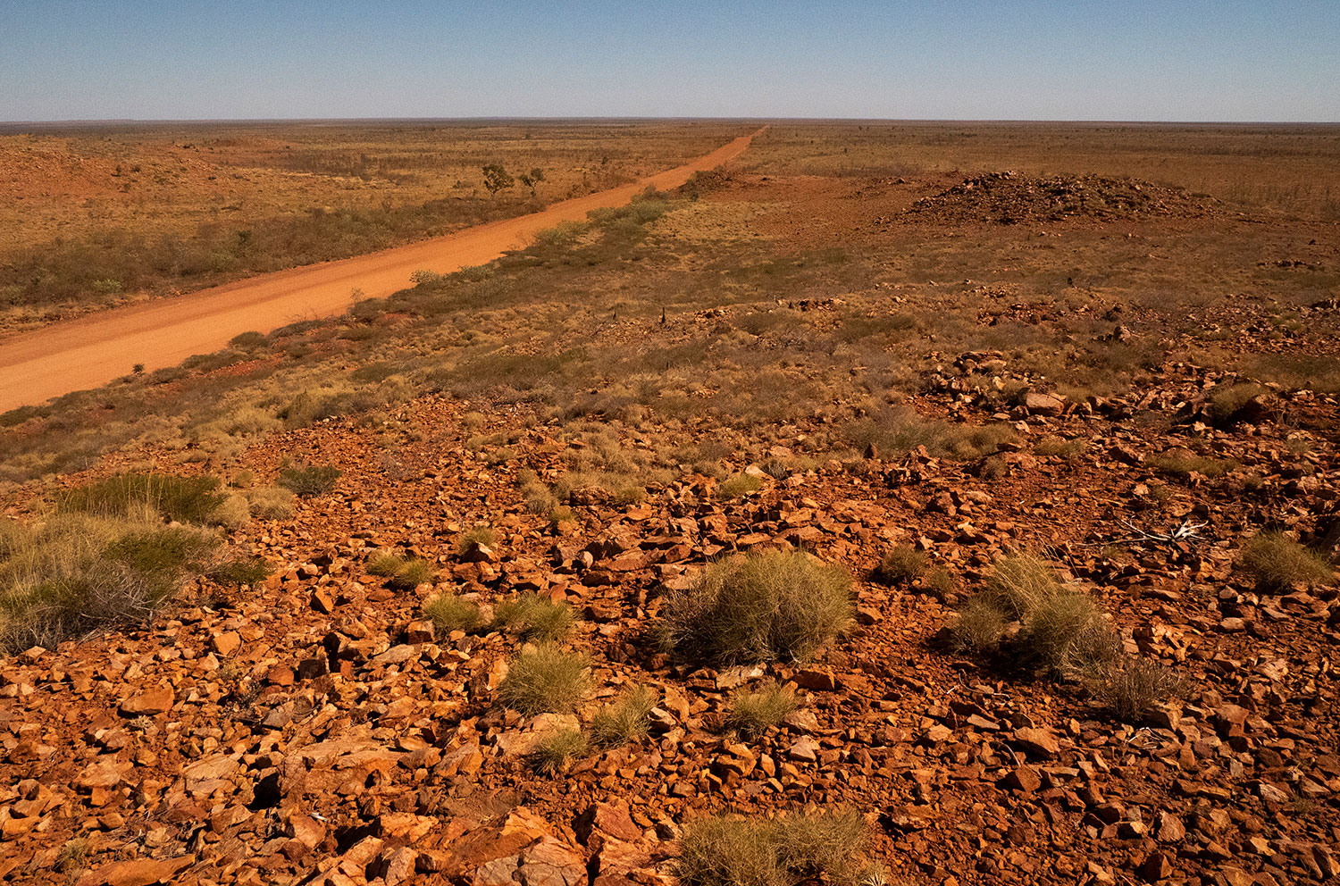
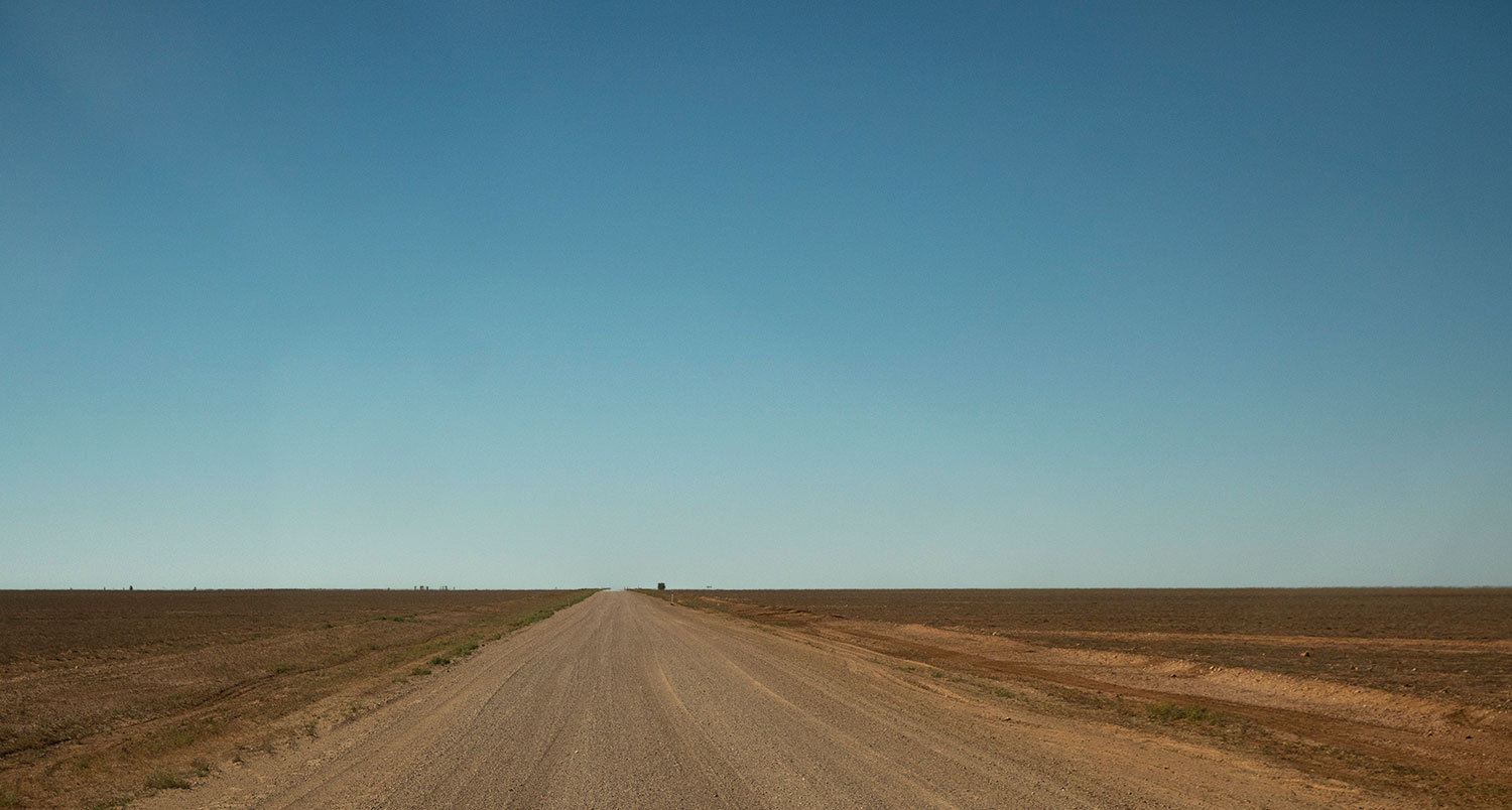
The Tanami Road cuts through the Tanami Desert from Halls Creek WA to Alice Springs NT

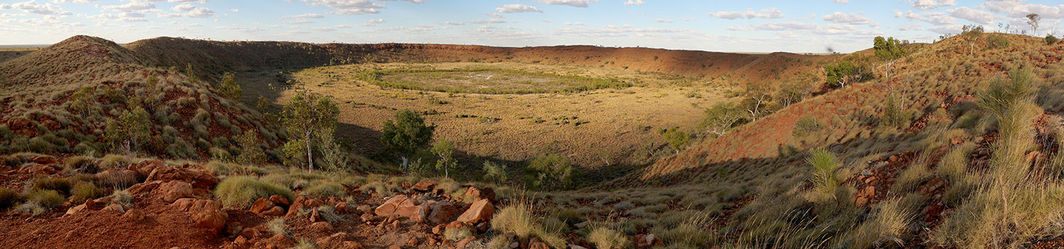
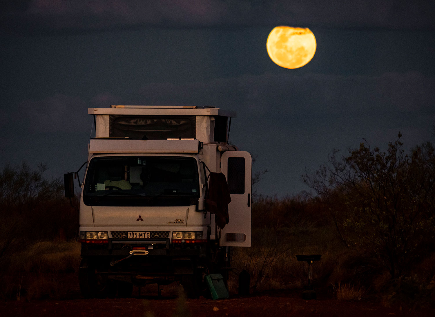
We spent a night at Wolf Creek Crater – Dianne, having not seen the movie, was pretty relaxed about camping there under a full moon, I had a bad nights sleep with a wheel brace under my pillow.

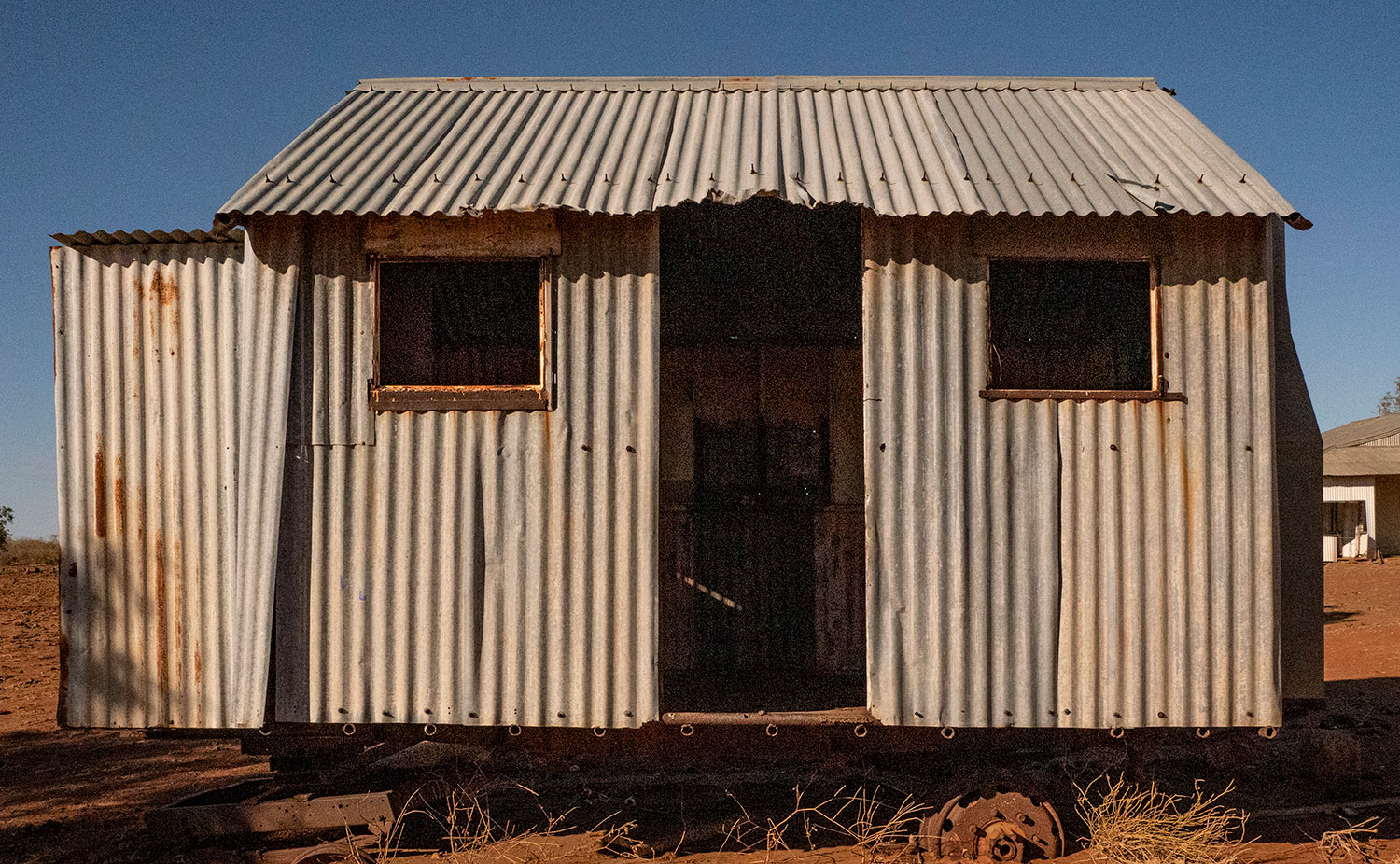
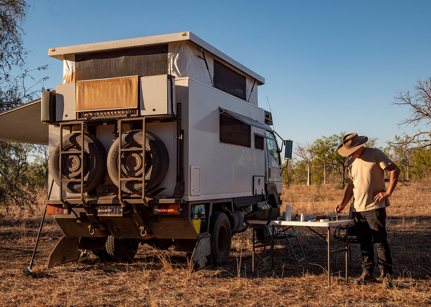
Believe it or not, this piece of corrugated iron architecture was on wheels.
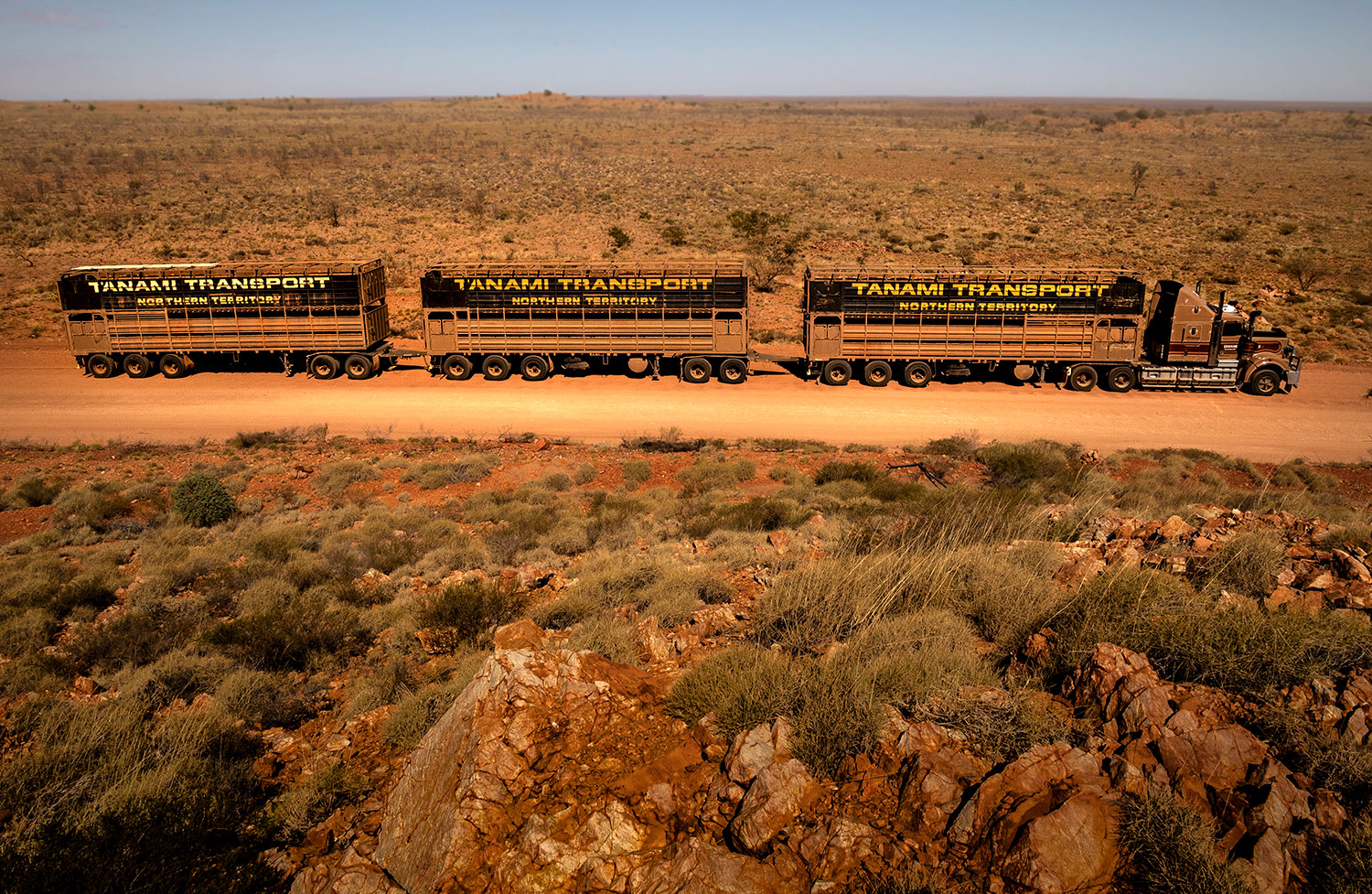
Tanami Roadtrain

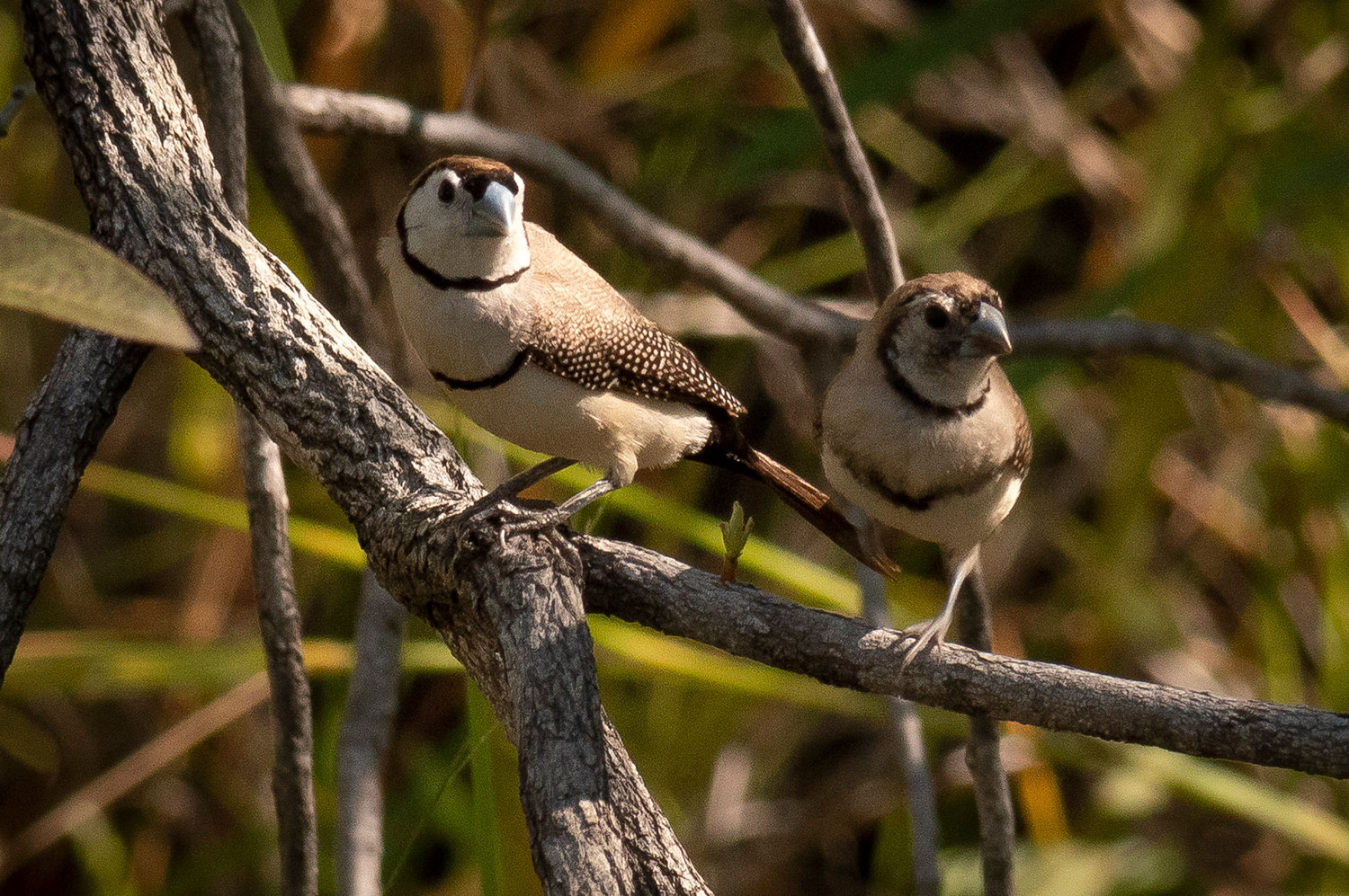
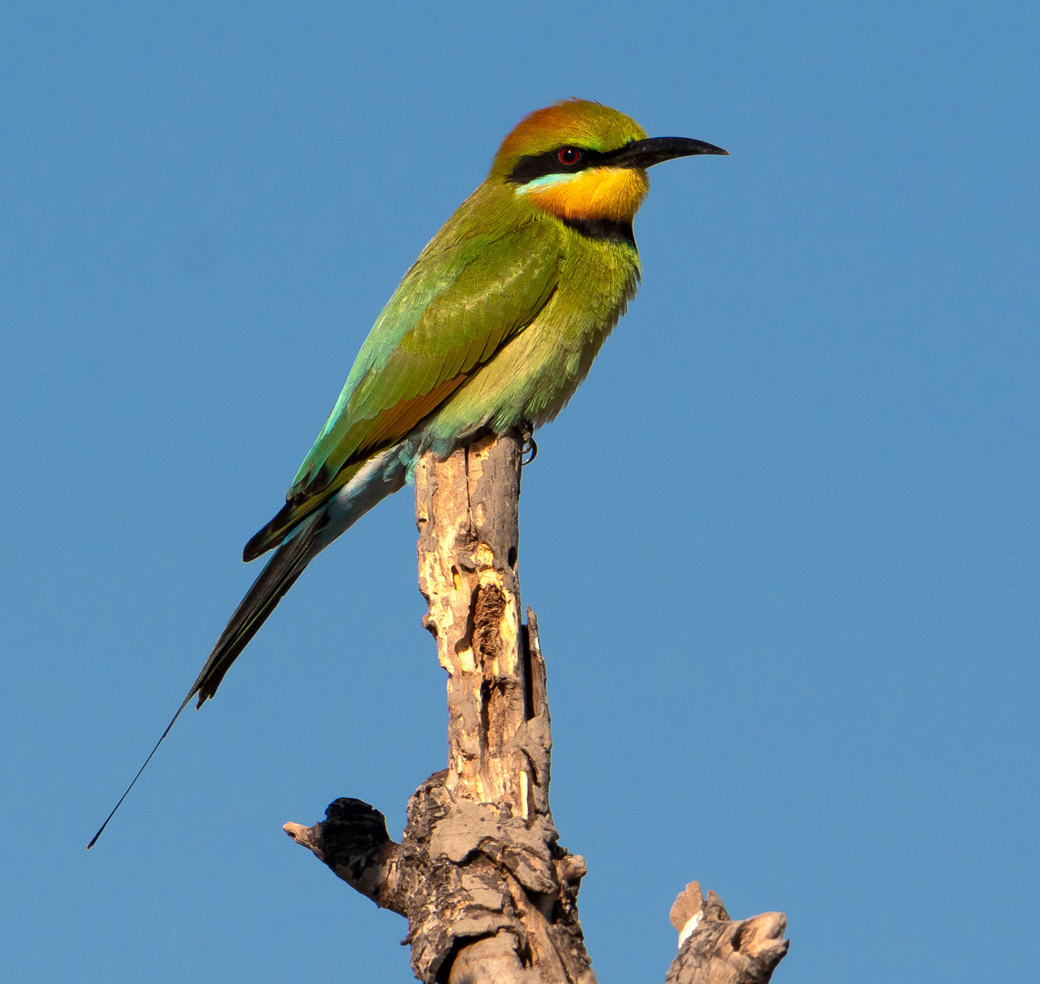
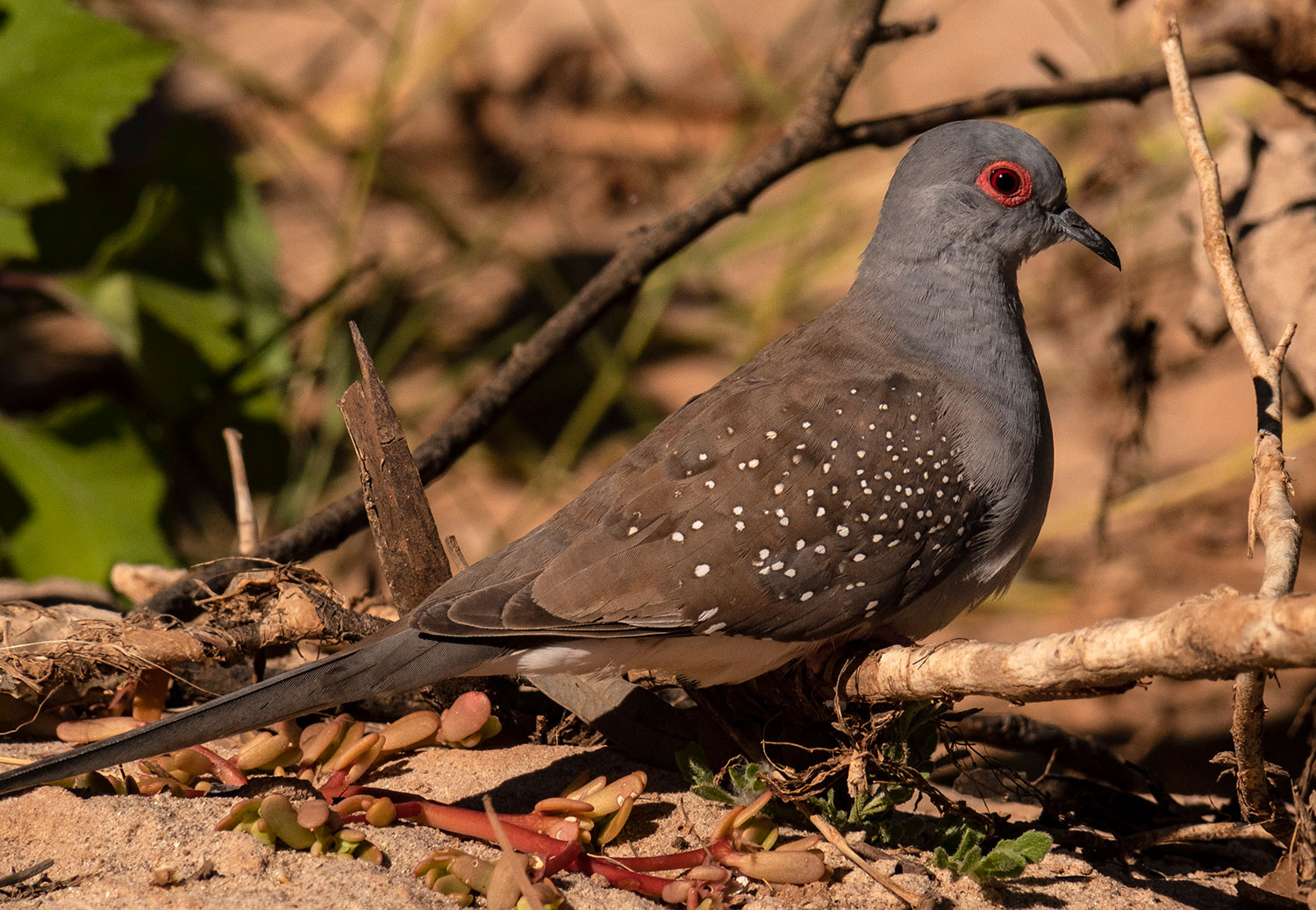
Finches at a rare waterhole along the Tanami.
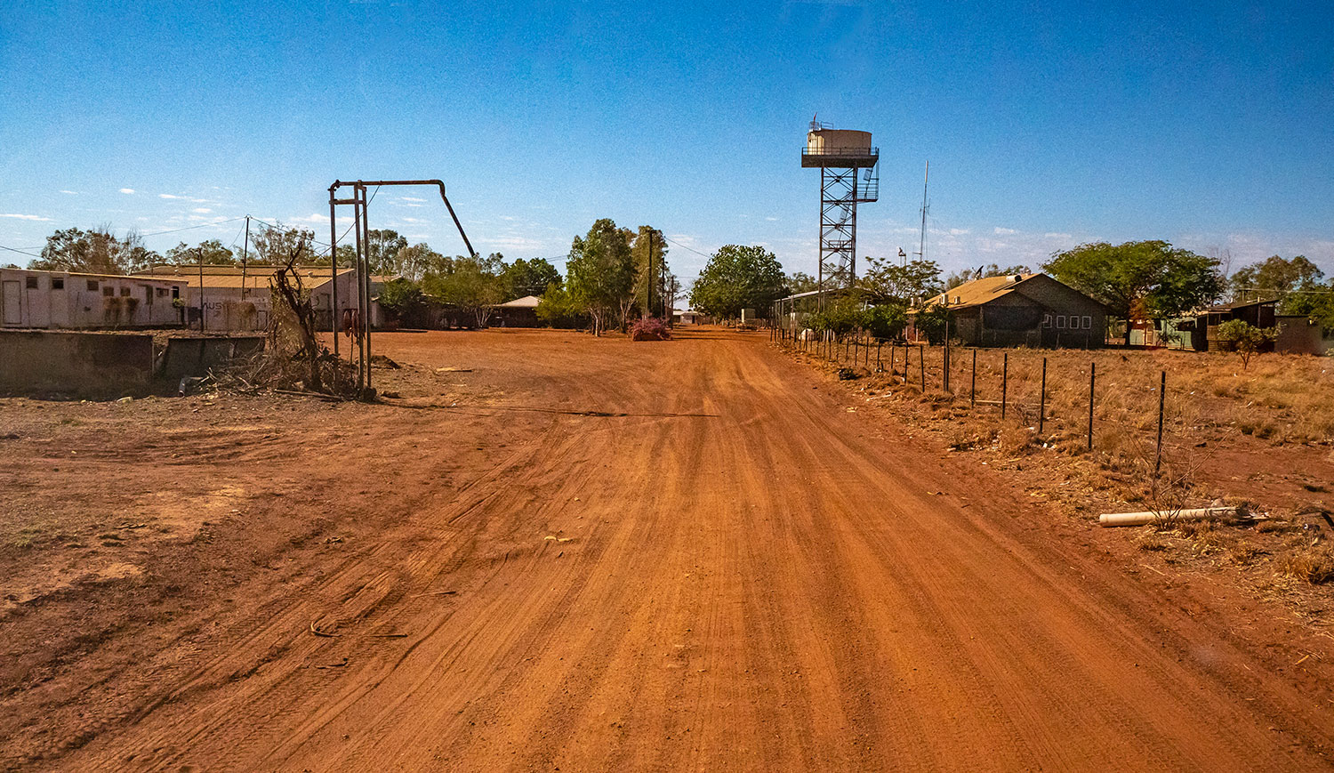
Billiluna Community

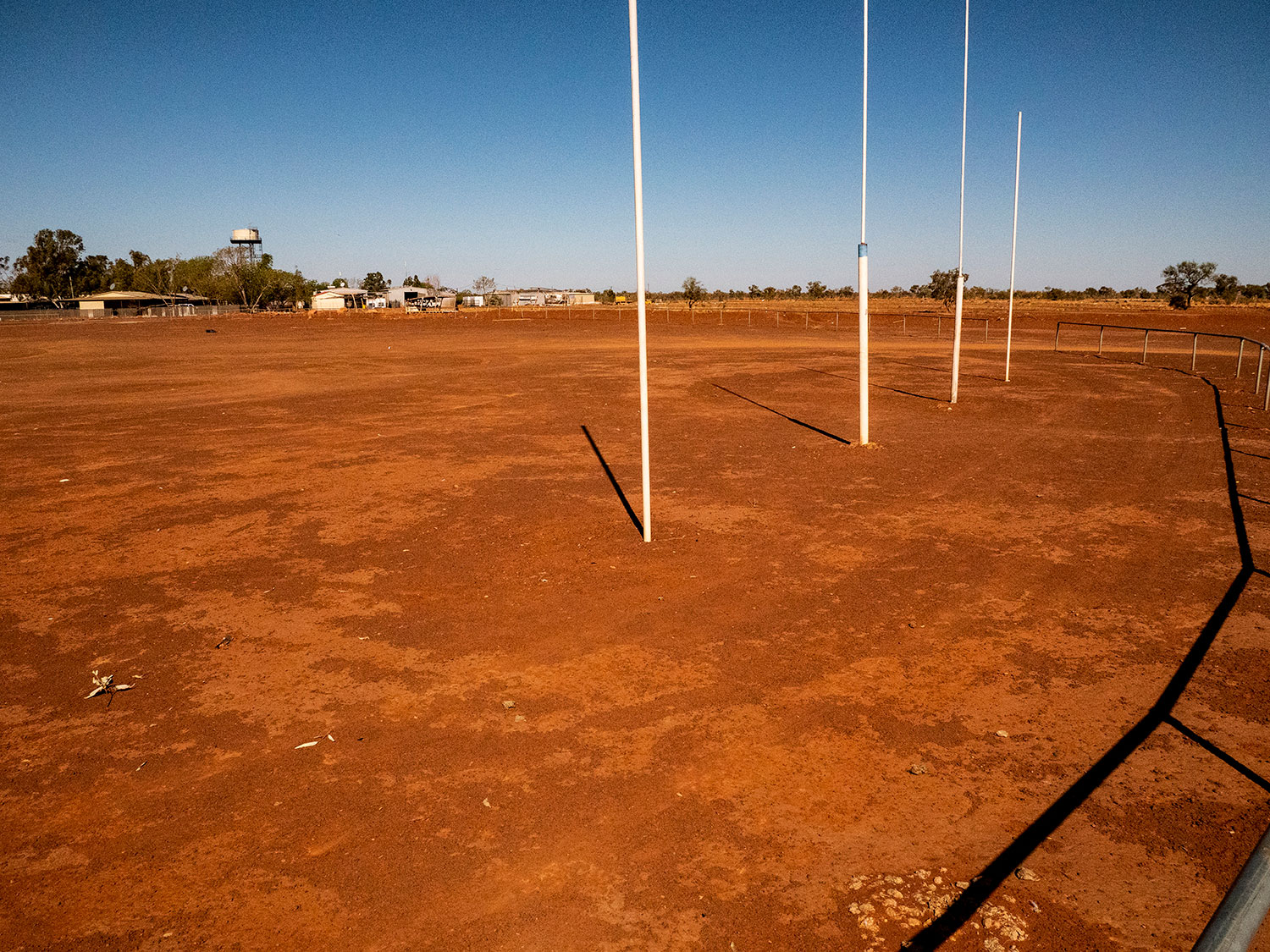
Billiluna Footy Field – all dust and rocks

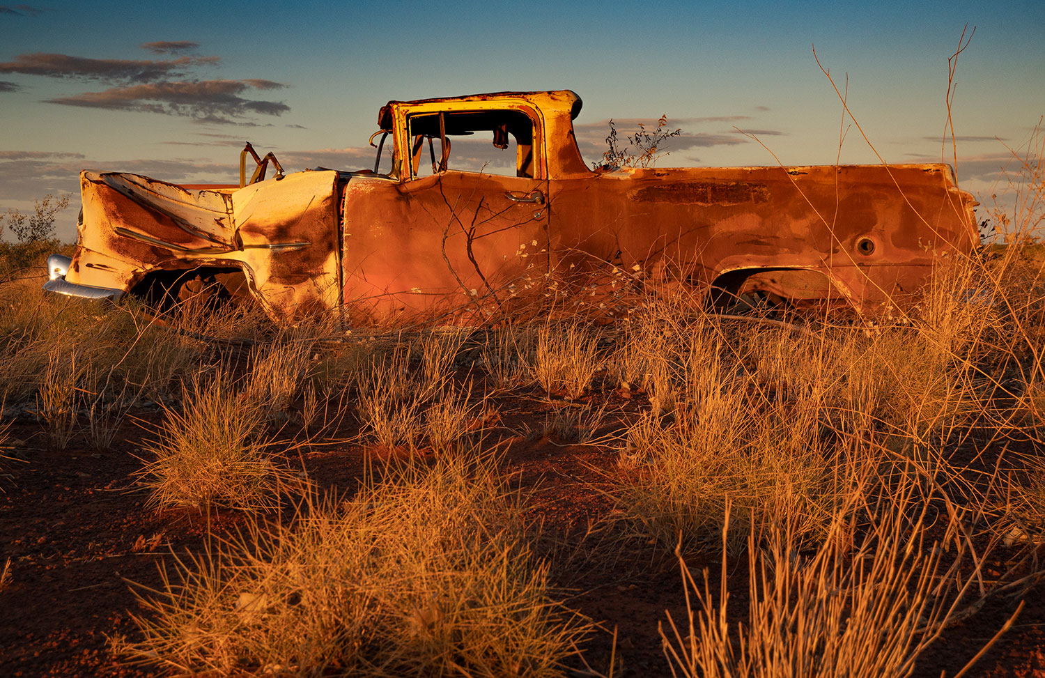
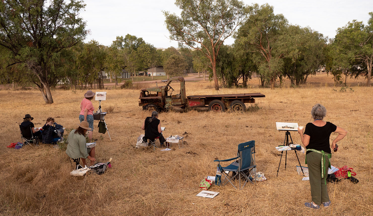
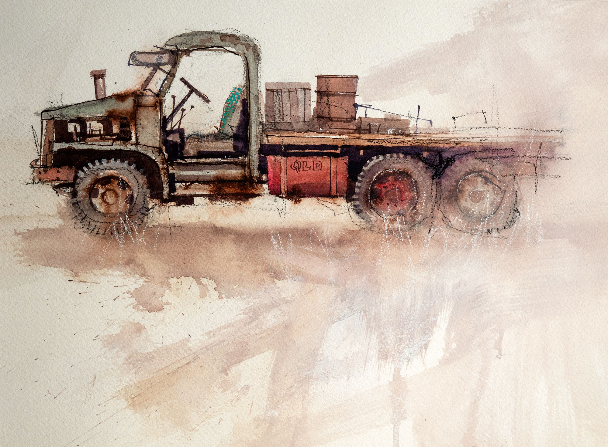
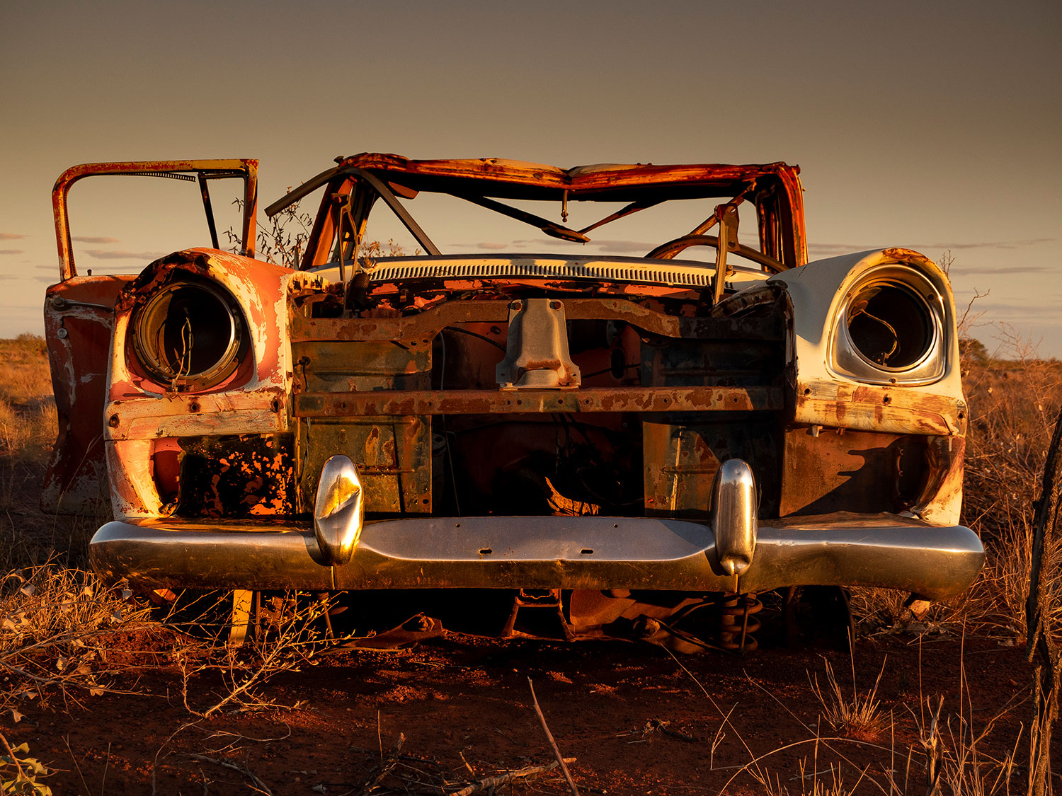
Can’t drive past a wrecked car without stopping to take a photo. This one was so good we camped the night to get the early morning sun.

Wedgetail enjoying breakfast.

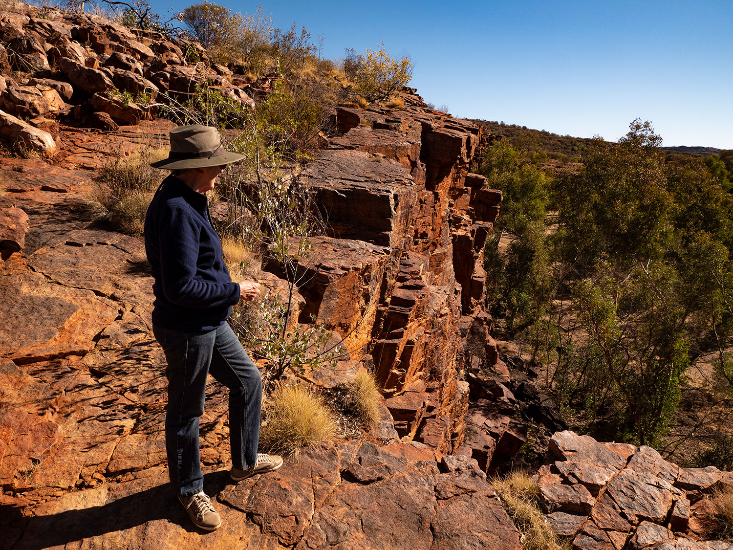
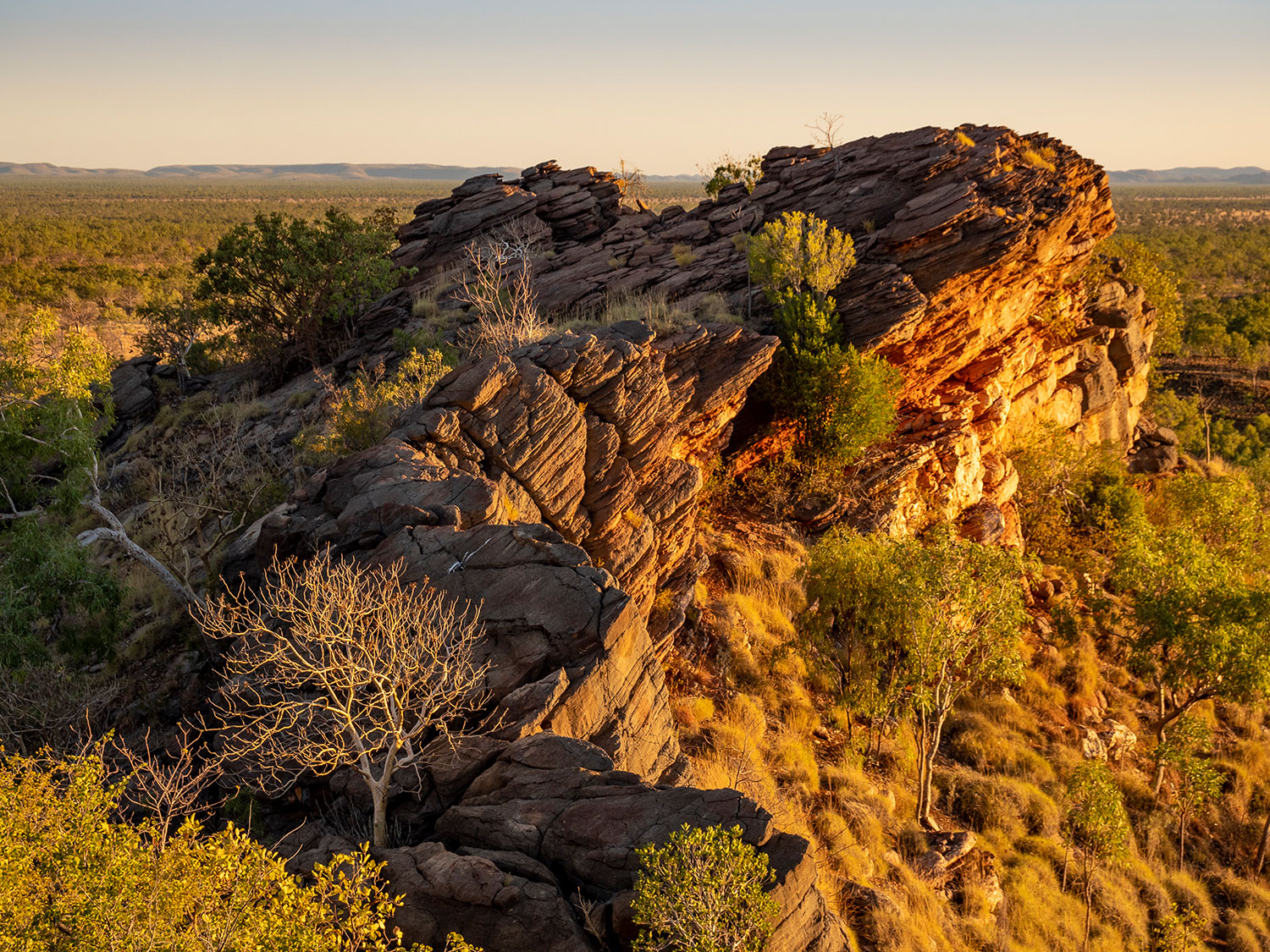
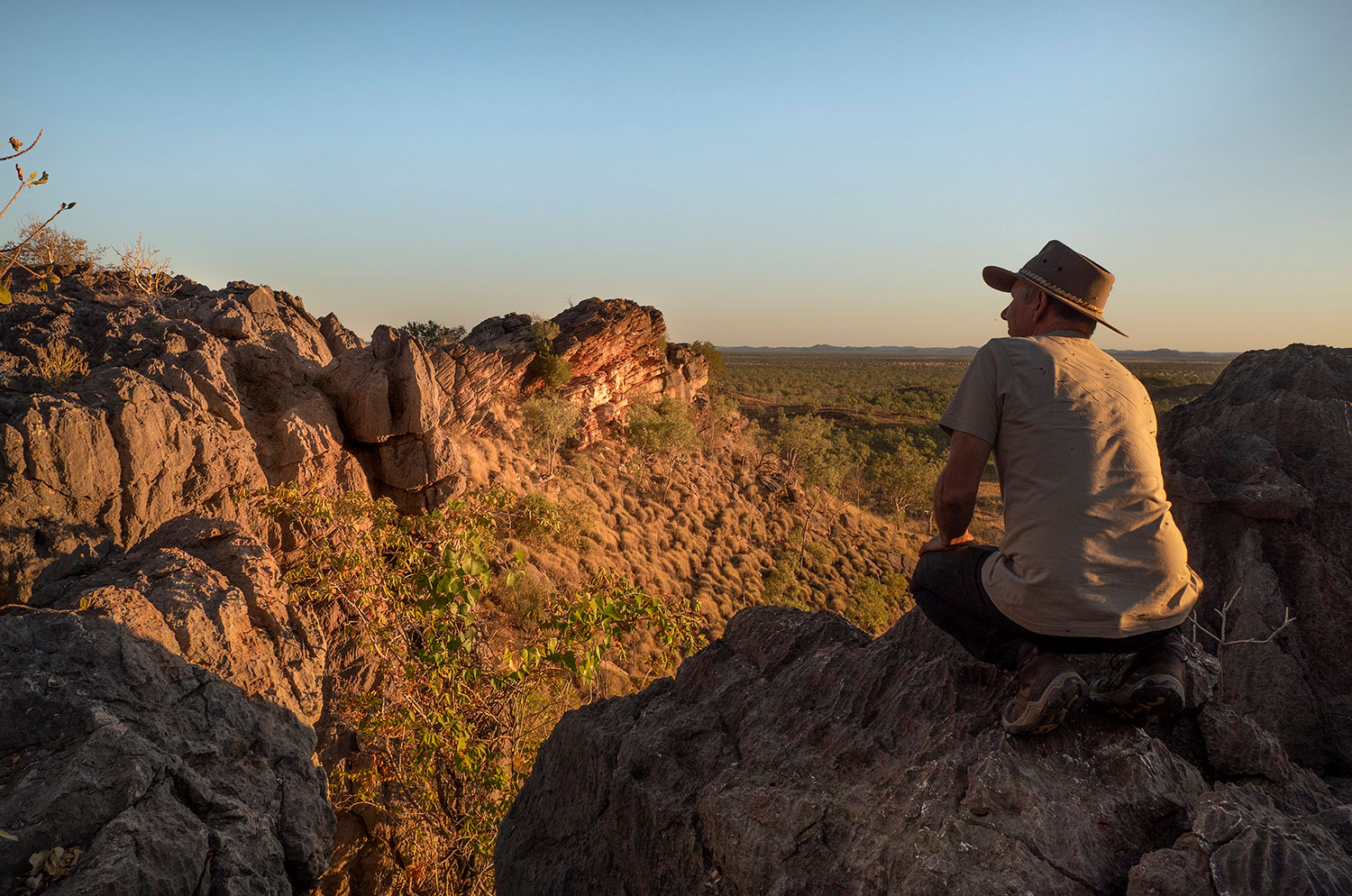
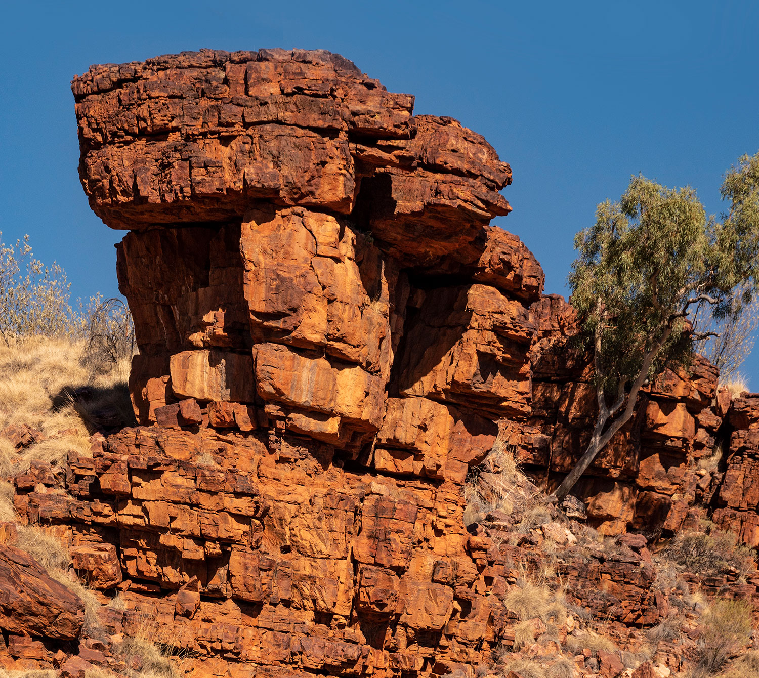
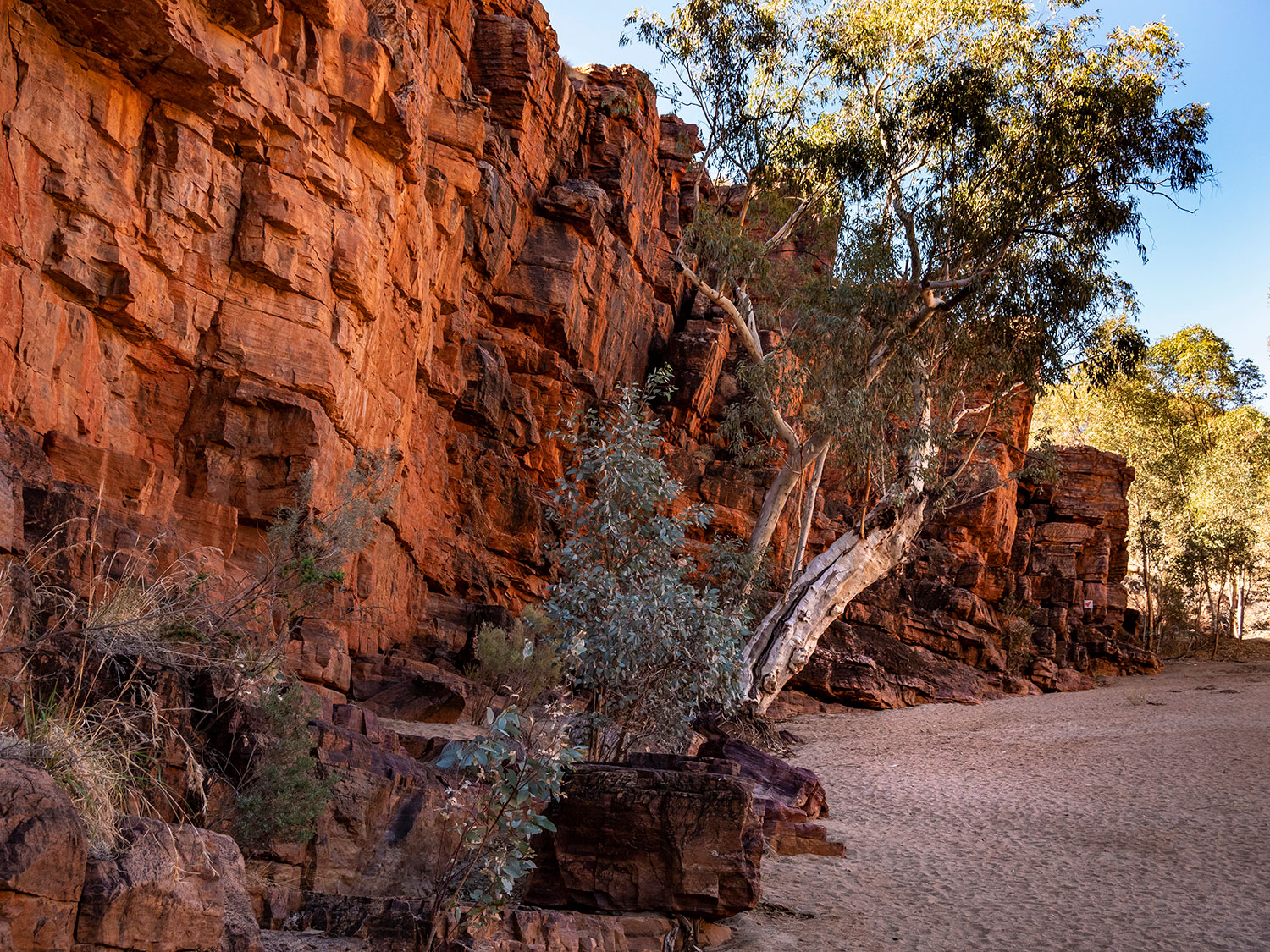
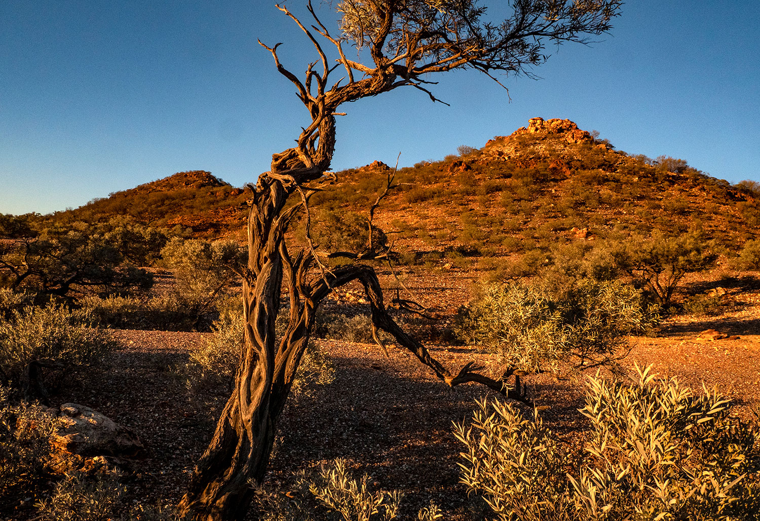
After stocking up in Alice Springs, we headed out to the Eastern MacDonnell’s for some pretty spectacular walks.

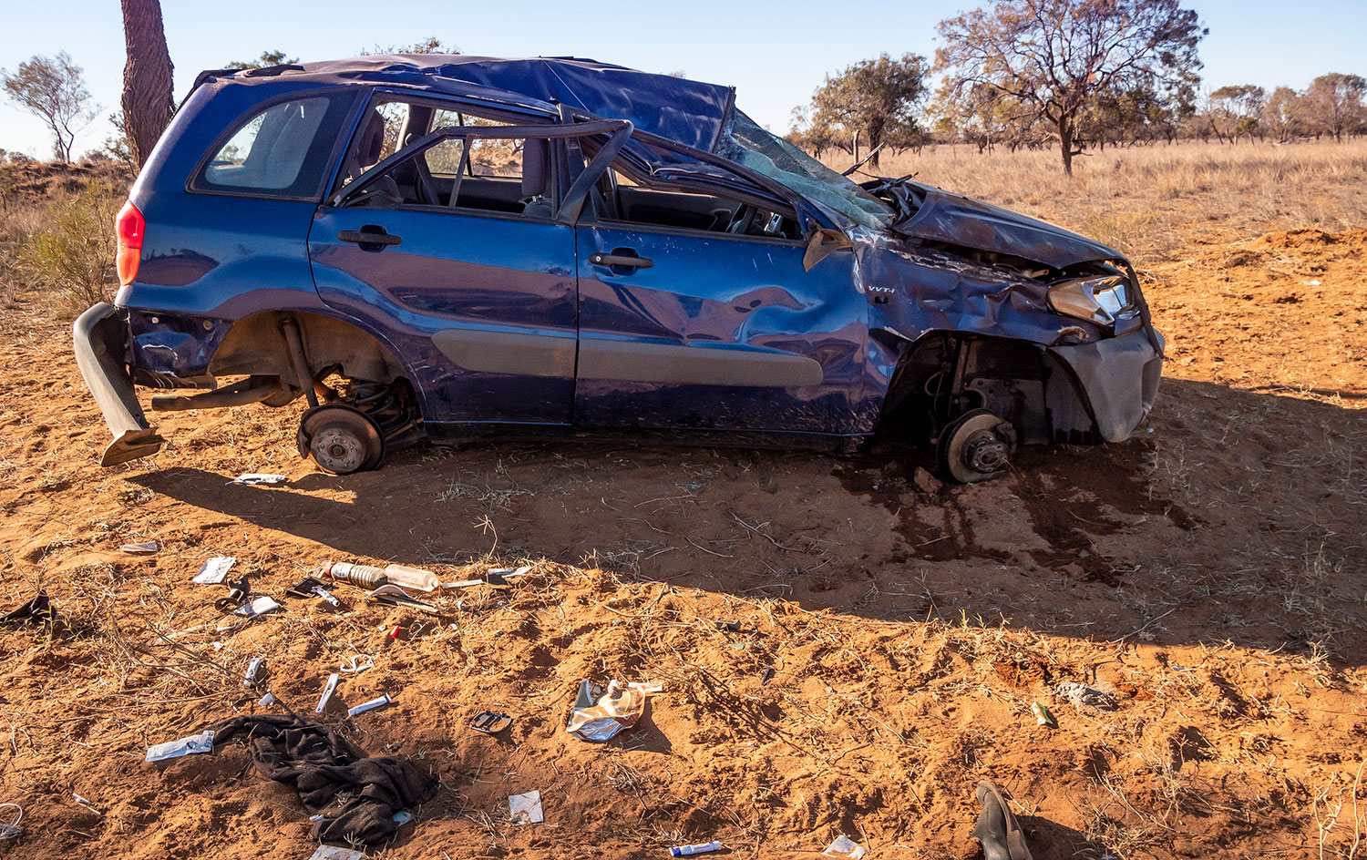
Not far down the Plenty Highway we came across this rolled Toyota. It must have been there a couple of days because all the wheels were gone. Judging by the scattered debris, it must have been some Japanese Tourists heading off on an adventure.

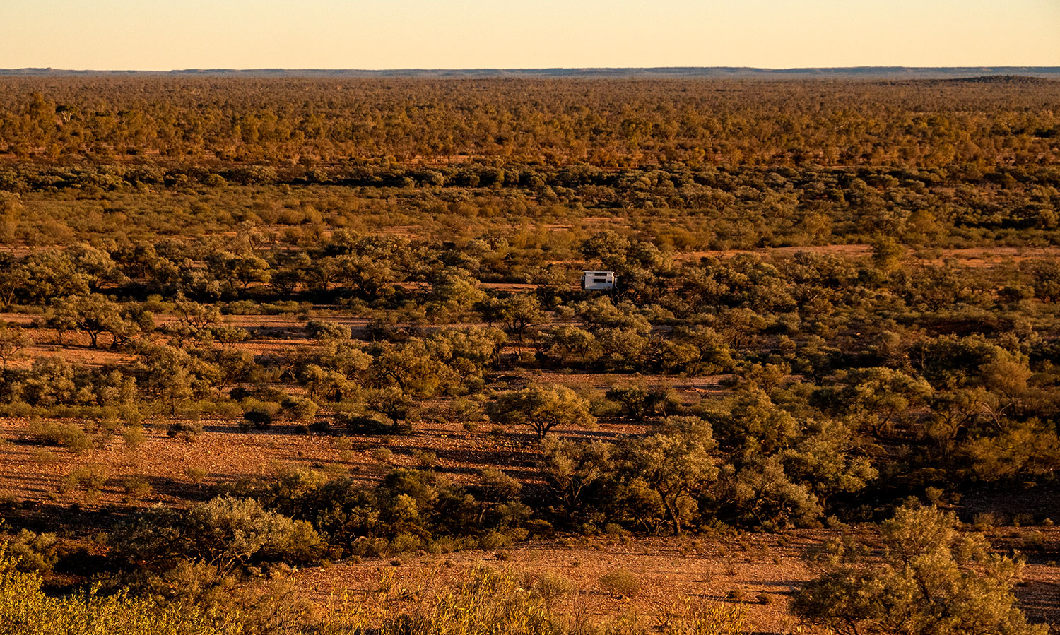
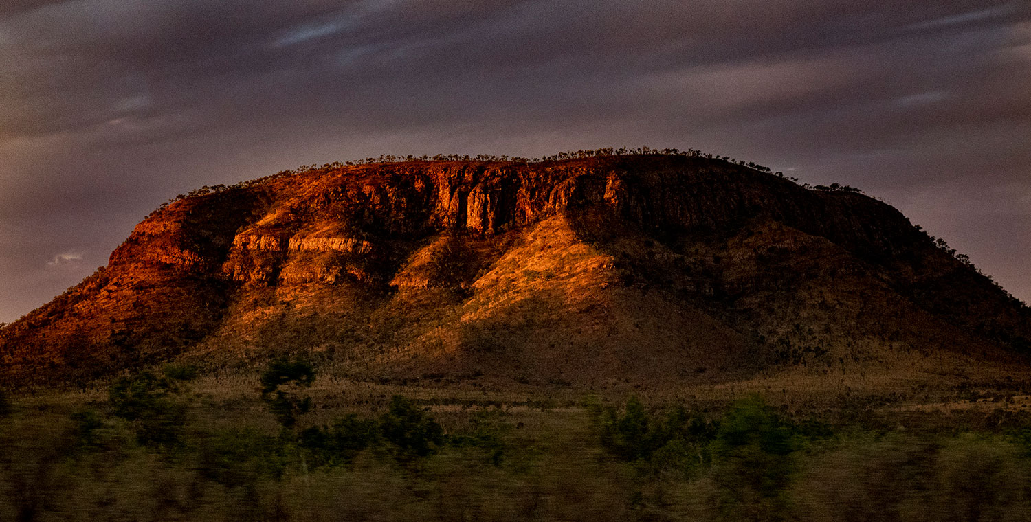
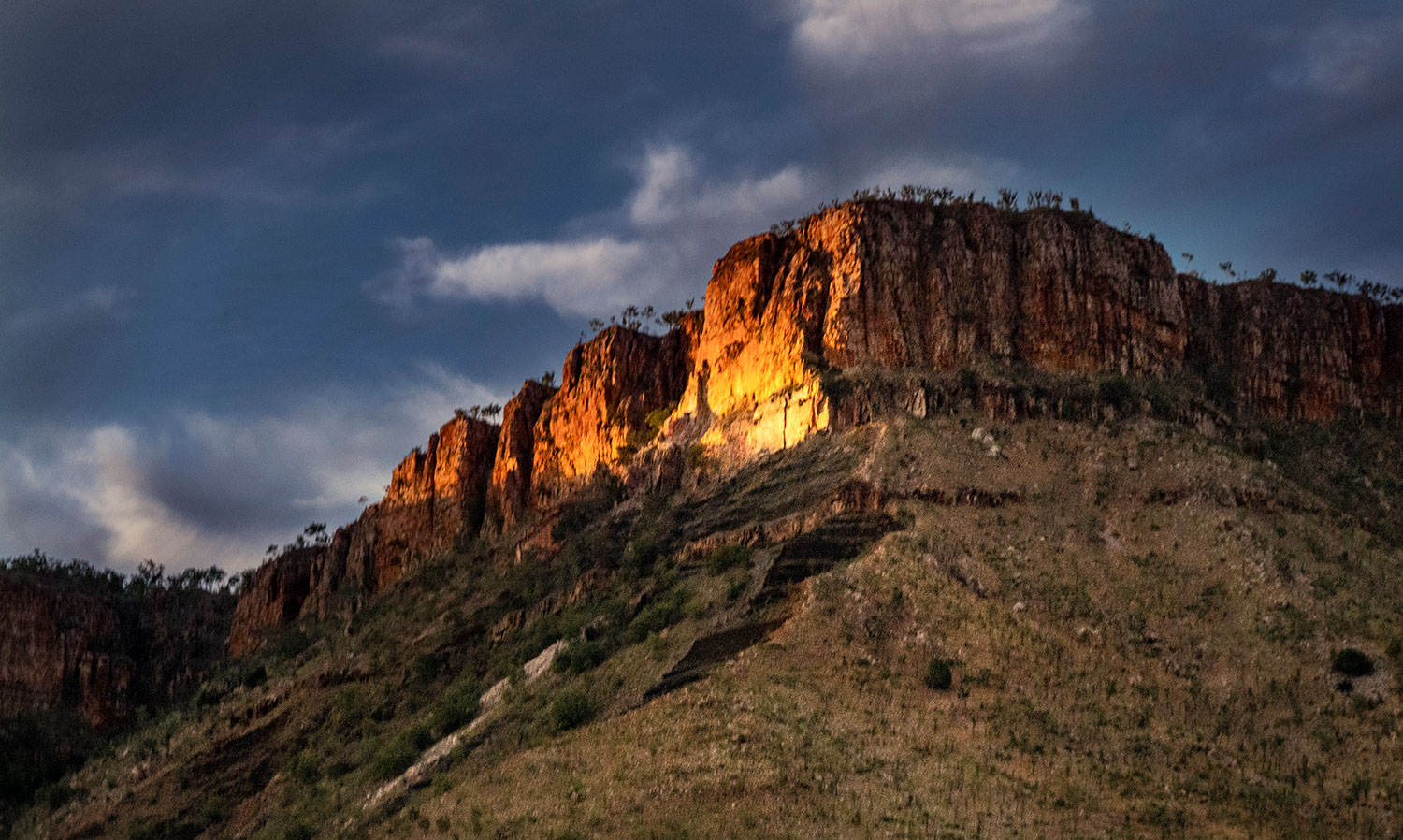
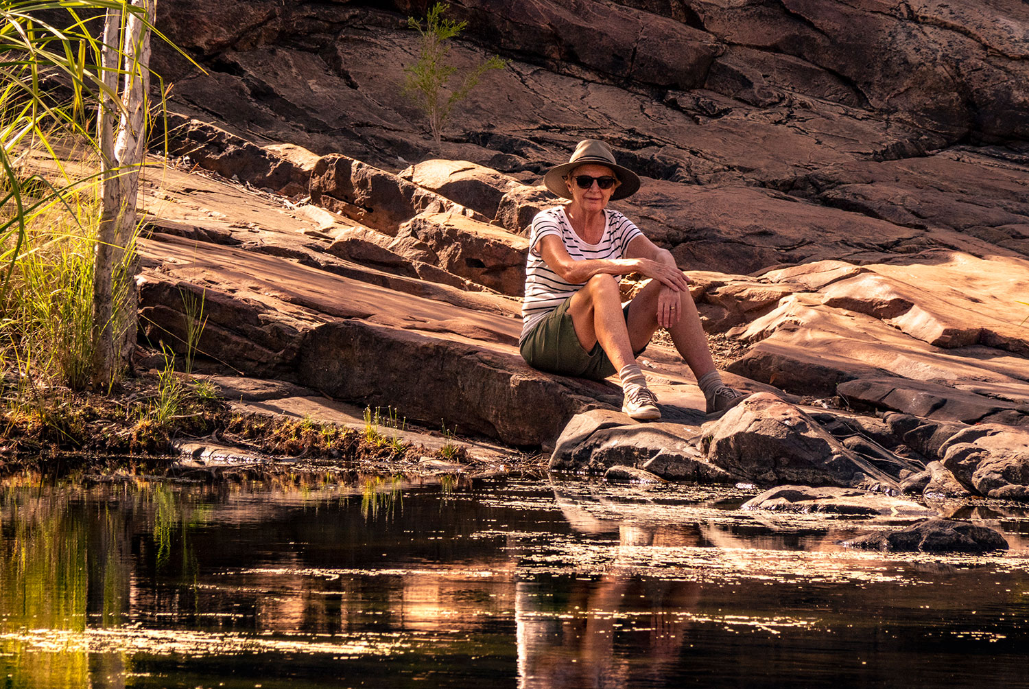
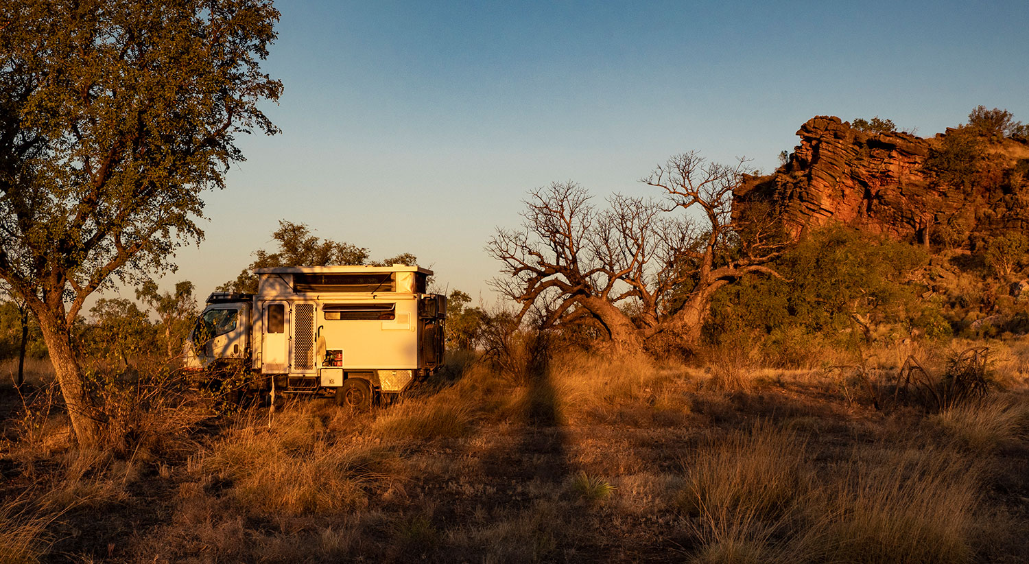
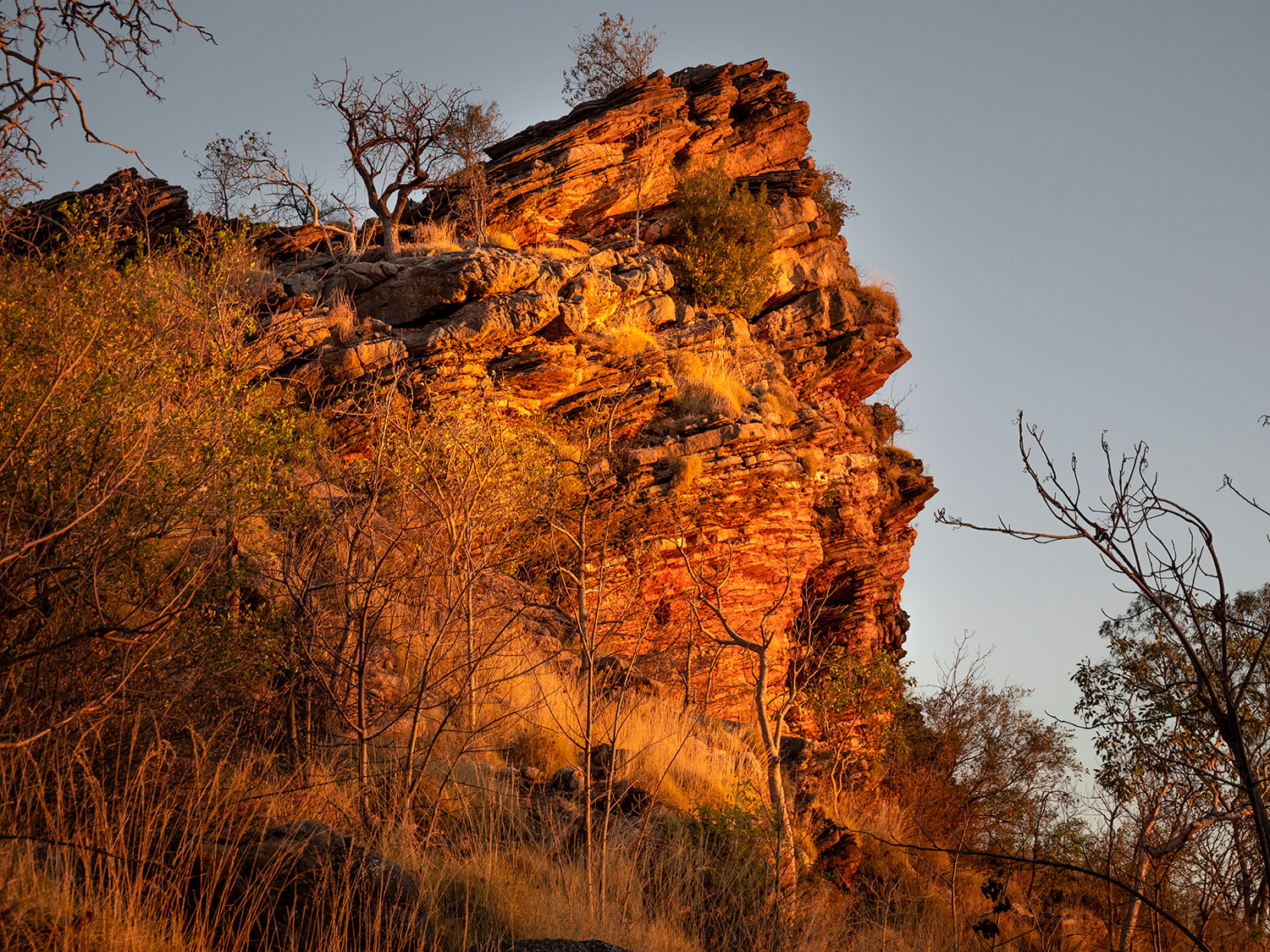
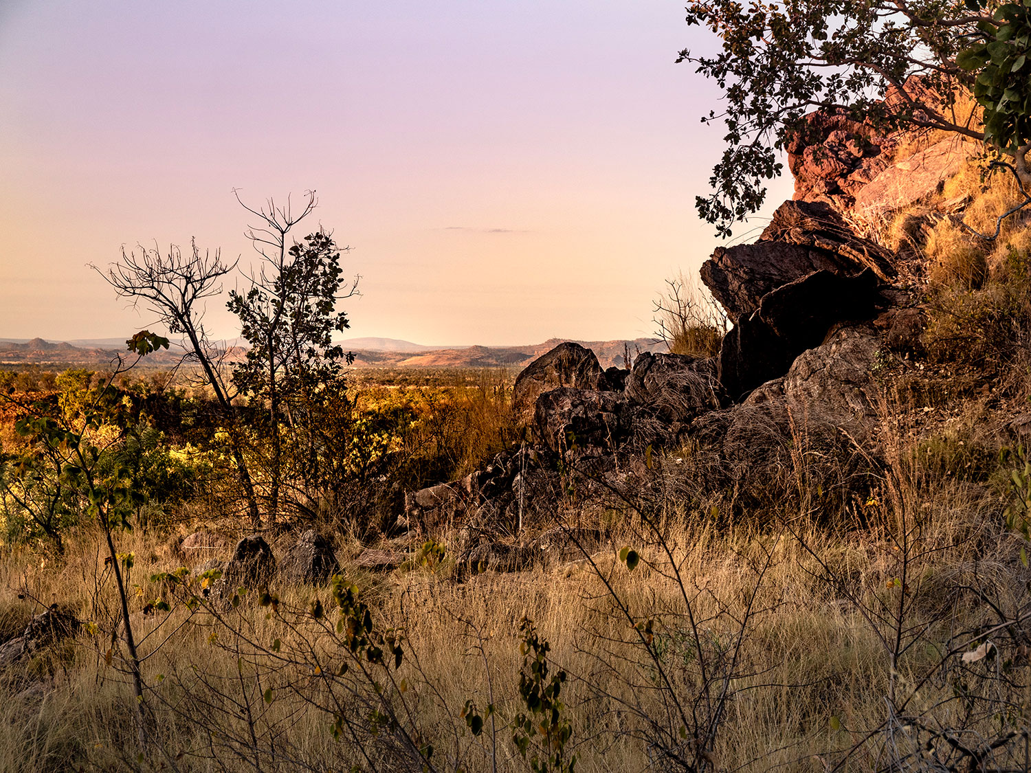
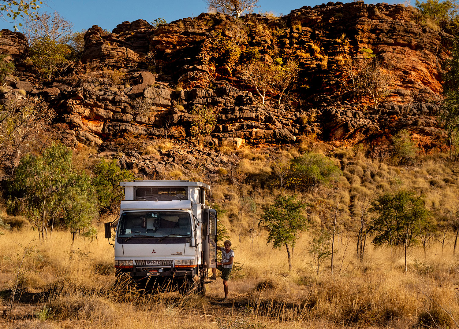
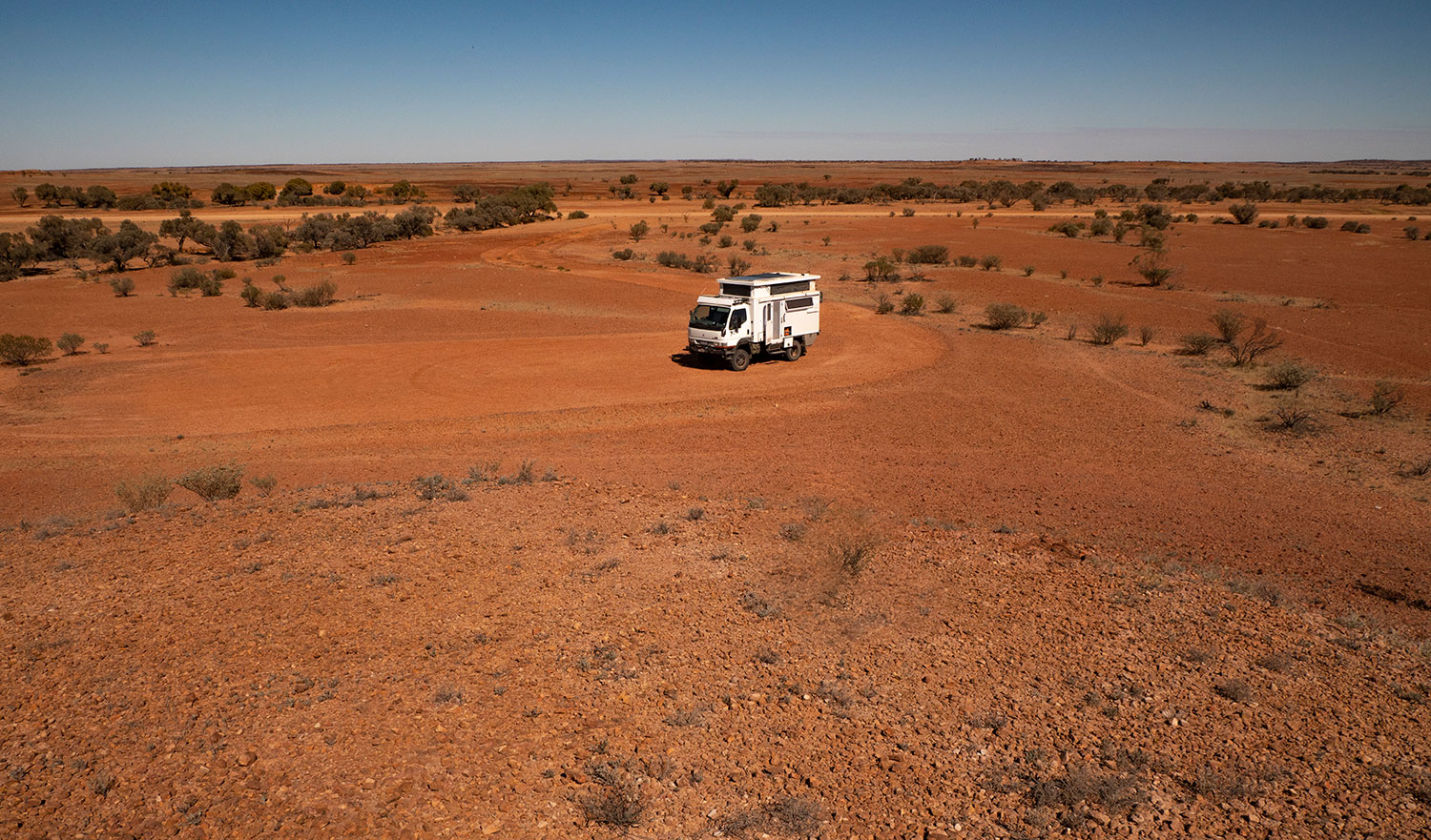
The white dot in the middle is our camp . Huge amounts of nothing through the middle of the Northern Territory, but when you stop and look around the scenery can be spectacular.
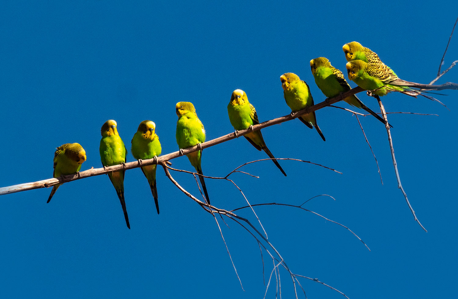
Budgerigars

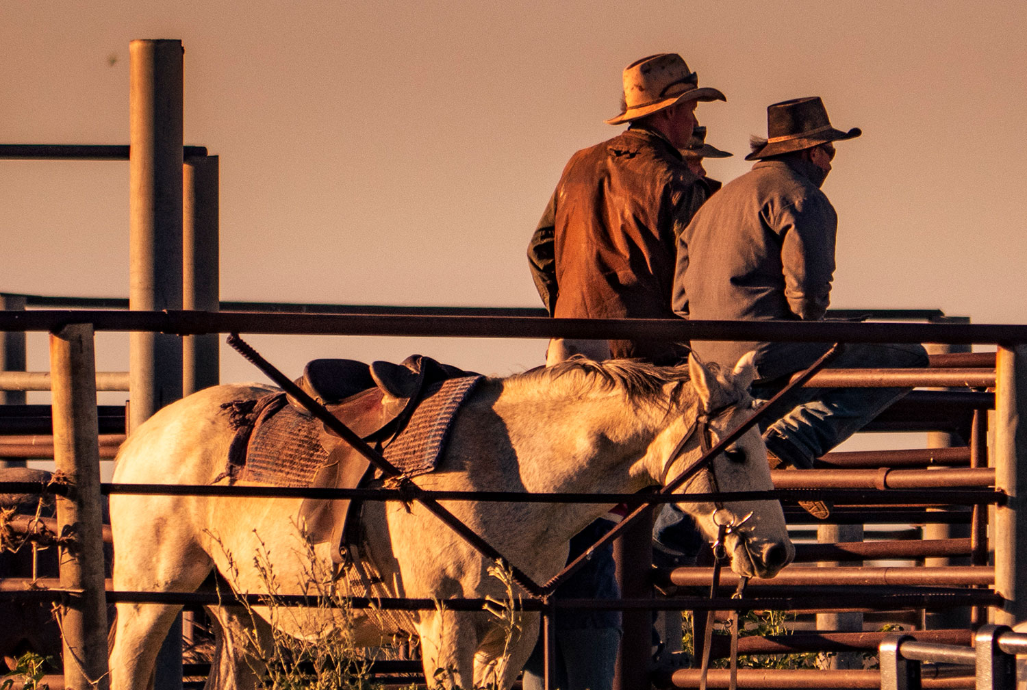
Stockmen at Tobermorey Station

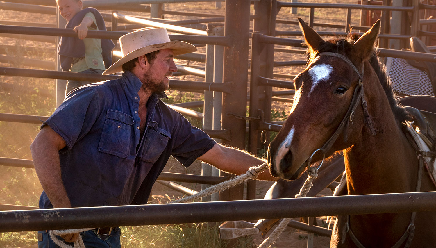
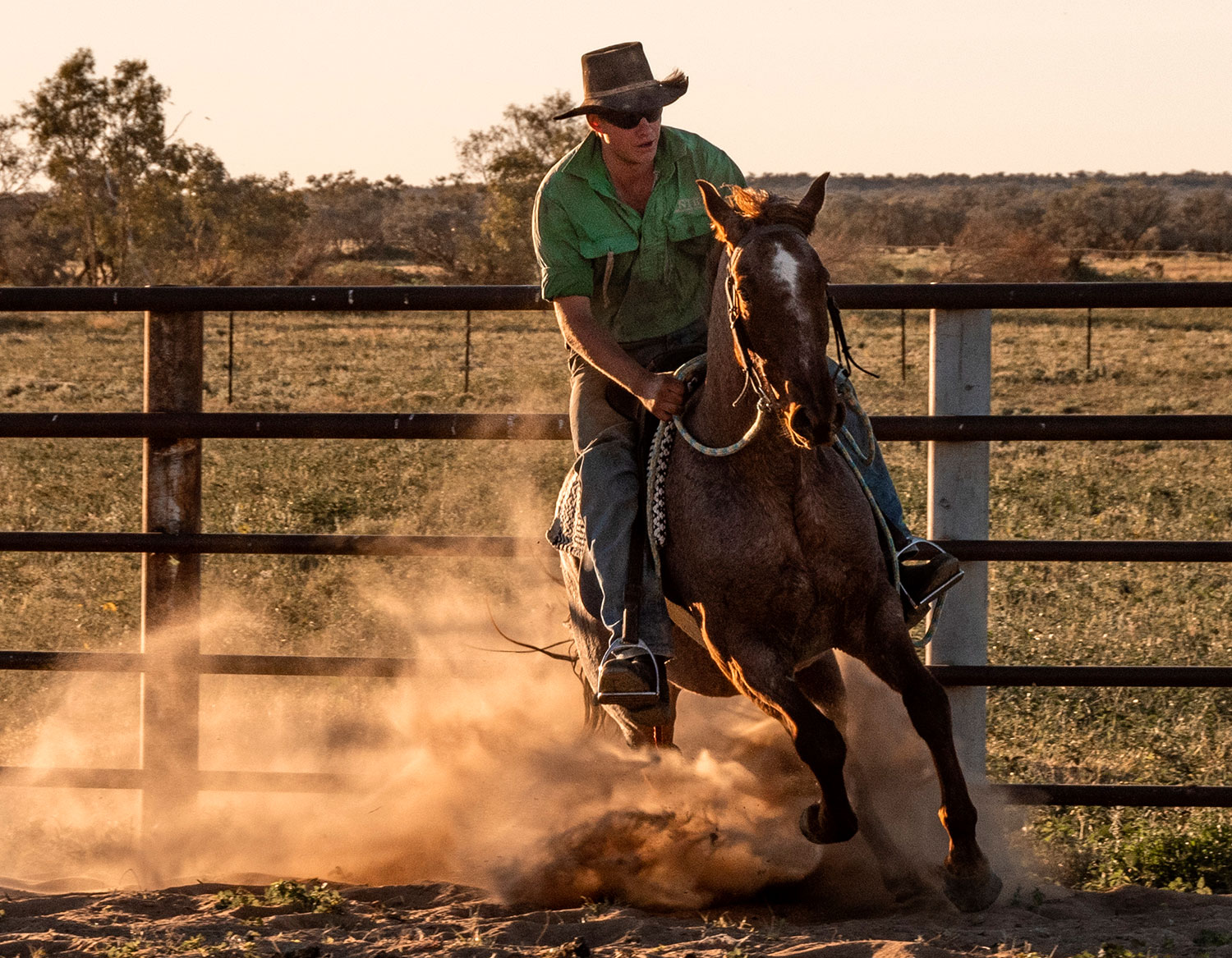
Tobermorey Horse Breaker
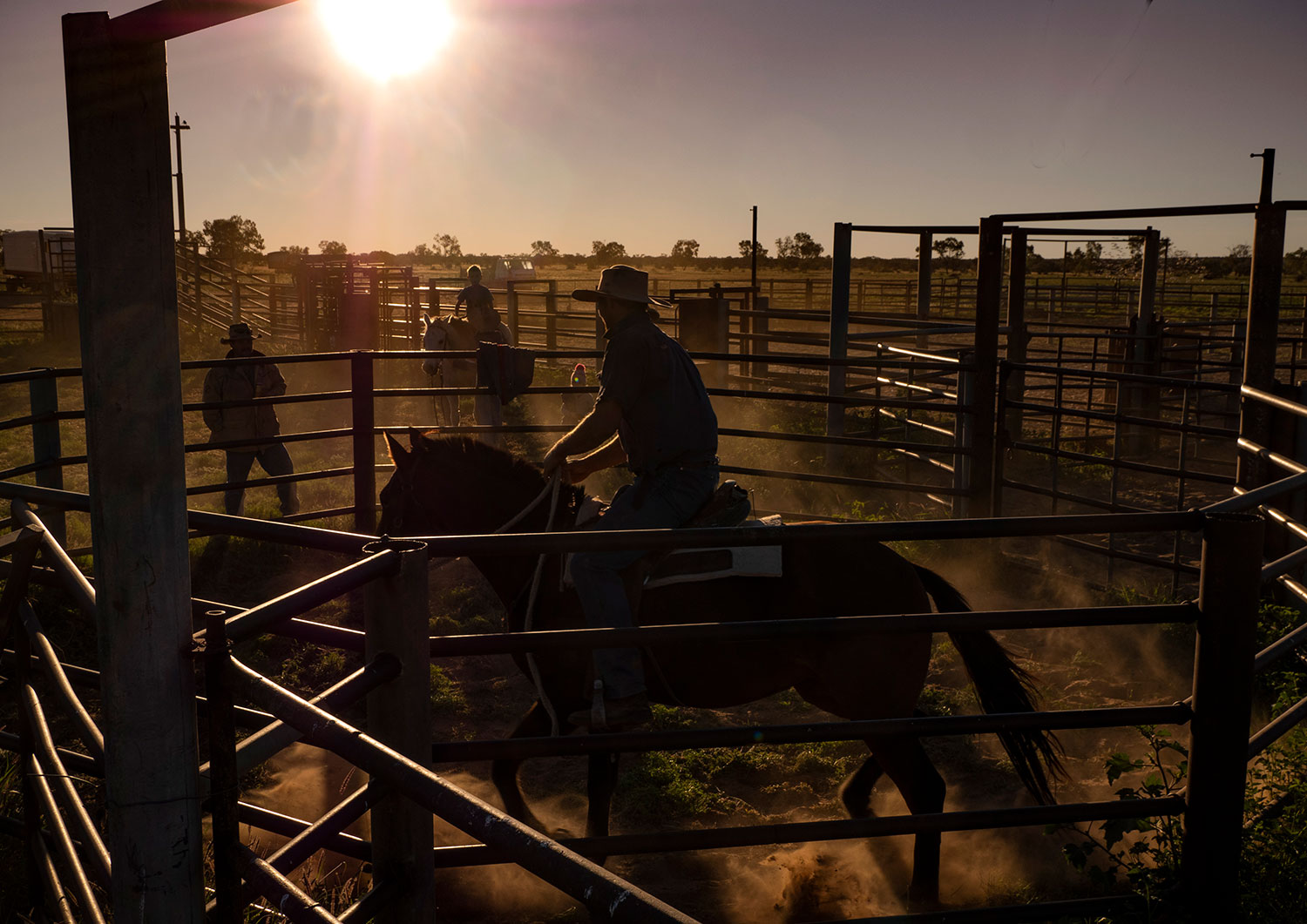
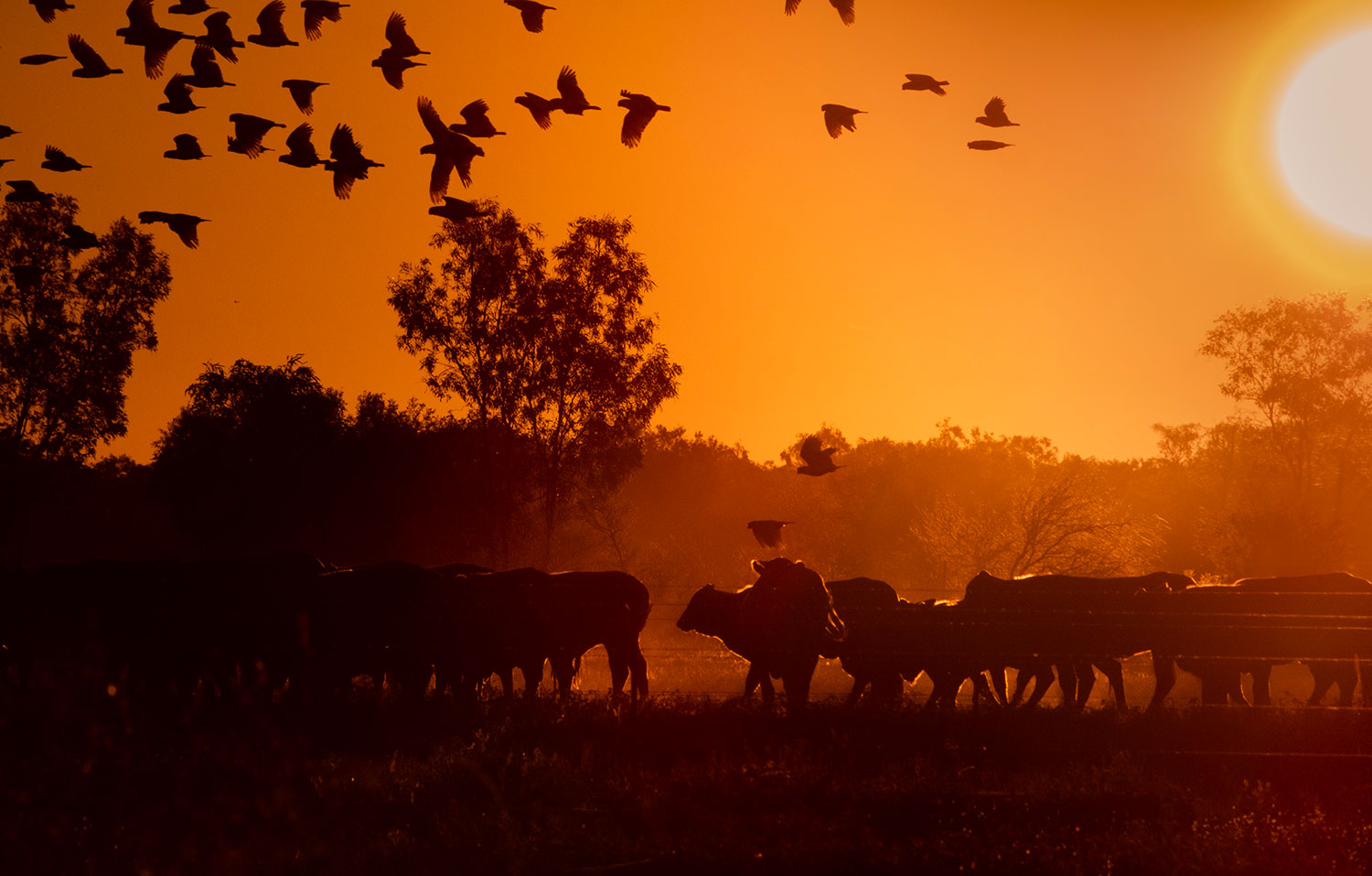
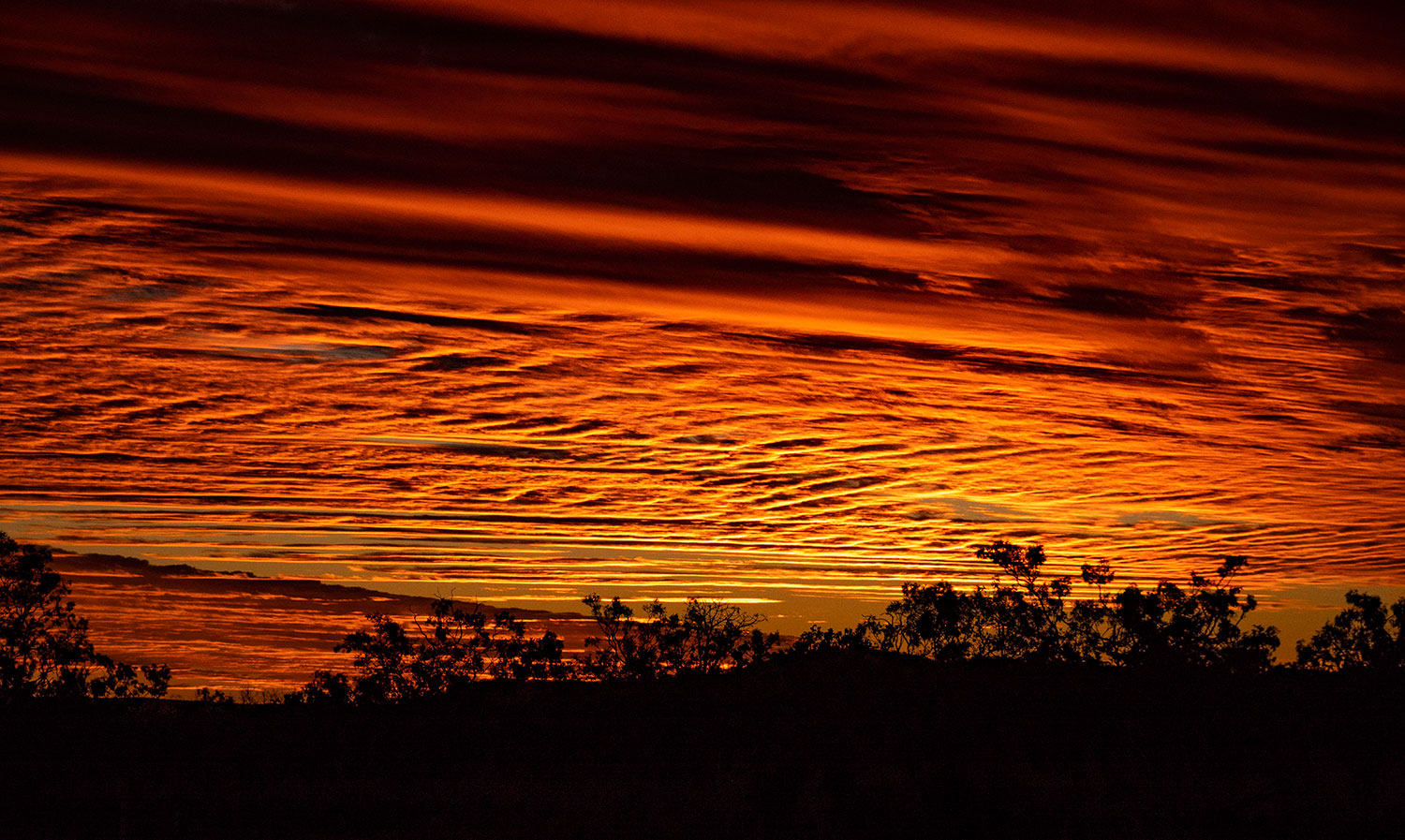
Tobermorey Sunset

Red dust

Crossing into Queensland, the Plenty turns into the Donohue. This was the smoothest dirt road we encountered

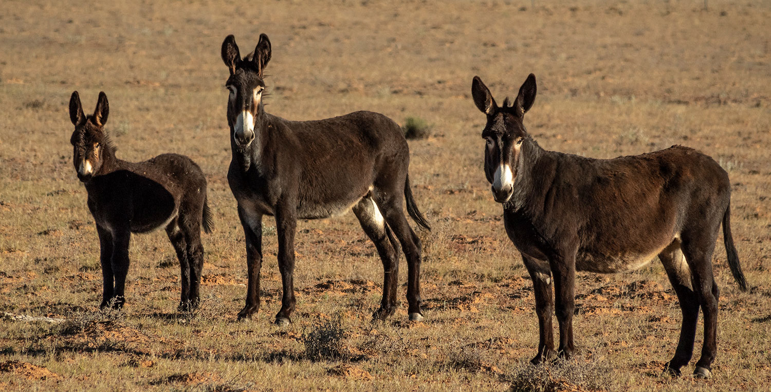
Donkeys watching Humans come to a sudden halt in a big cloud of dust.

ROCKS AND BOABS

Our Outback Workshop moved from Kakadu/Litchfield, over to Kununurra via Katherine. Moving across the boarder into Western Australia brings a change in the landscape from speargrass savannah to rocky outcrops and giant Boab trees. The landscape was unusually dry for this time of year. Normally creeks are full, waterfalls are flowing and the landscape is greener but, unfortunately,  the last wet season was almost non existent.

© John Lovett 2019
© John Lovett 2019
Spectacular, close up view of Katherine Gorge

© John Lovett 2019
Kununurra sunset changes the landscape completely
© John Lovett 2019
© John Lovett 2019
© John Lovett 2019
Couldn’t resist painting this old Studebaker truck at El Questro Station

© John Lovett 2019     © John Lovett 2019
Rock Wallaby keeps watch over Chamberlain Gorge

© John Lovett 2019
Chamberlain Gorge

© John Lovett 2019 © John Lovett 2019
Distorted landscape around Lake Argyle

After the Outback Workshop finished, Dianne and I collected our truck we had stored in Kununurra and headed of down the Gibb River Road via Wyndham and Parry Lagoon
© John Lovett 2019
© John Lovett 2019
© John Lovett 2019
© John Lovett 2019

© John Lovett 2019

Bell Gorge – one of the many waterholes along the Gibb River Road
© John Lovett 2019
Water Monitor – Bell Gorge
© John Lovett 2019
© John Lovett 2019

At the end of the Gibb River Road is the Napier Range. A spectacular band of twisted Limestone running East West across the Southern Kimberley. We spent a few days camped under the range painting, walking, sketching and photographing

© John Lovett 2019
© John Lovett 2019 © John Lovett 2019
Bee hive in a cave in the Napier Range

© John Lovett 2019
Outside Studio

© John Lovett 2019
© John Lovett 2019 © John Lovett 2019 © John Lovett 2019   © John Lovett 2019 An amazing place to paint and explore

JAMIE NICOLAOU

I was fortunate to cross paths with Jamie Nicolaou while we were in Western Australia. Jamie is the son of  long time friends we stayed with near Manjimup. He has an amazing passion for photography, a great eye for a good shot and a humble attitude to his wealth of knowledge.

It was inspiring to go out with Jamie and watch as he shot a panorama of the family farm just as the light faded to dark. I then followed him through the process of turning it into the image you can see on his blog. The incredible thing about this image is that it’s resolution is high enough to produce a print measured in meters not centimeters!

Check out Jamie’s blog http://jamienicolaou.wordpress.com/

…and his website http://actionpics.com.au

Jamie Nicolaou – Photo by Tegan Studsor

ACROSS THE NT BORDER

gsr map

IMGP1946

Approaching the NT border towards Docker River, the country changes into a series of spectacular ranges.  Reading Herbert Basedows 1903 journal of exploration through this area made it all the more fascinating. There were no tracks and the journey took him 8 months with a team of 18 camels.

IMGP1952

IMGP1948

IMGP1965

All along the Great Central Road are herds of wild camels. This old fellow was standing under a shady tree just outside Docker River.

IMGP1956

Approaching the NT WA border through a cracked and bug splattered windscreen.

IMGP2014

We camped the first night back in the Northern Territory between sandhills with a great view of Kata Tjuta (The Olgas).

IMGP2054

Ayers Rock (Uluru) is an awesome sight. Photos are useless, it is so massive – the only way to appreciate it is to visit it.

IMGP2045

These strange characters, walking up to a viewing platform near Kata Tjuta, wore bags over their heads to annoy the flies!

IMGP2061

Around 50 kilometers east of Uluru is Mt Connor. It is like the poor cousin to Uluru, given just a passing glance thanks to it’s famous neighbour.

IMGP2067

I climbed to the top of a high sandridge to get a photograph of Mt Connor. In the distance to the north I could see a large salt lake half filled with water. An unusual sight in Central Australia.

We traveled East to the Stuart Highway then turned South through gathering storm clouds to South Australia.

IMGP2091

CAMEL IN WATERHOLE

The Great Central Road skirts the Gibson and Great Victoria Deserts so water is pretty scarce. There are, however, a number of rockholes with permanent water scattered throughout the region. Whenever we saw one marked on the map we would seek it out with the aid of a GPS.

IMGP1803

IMGP1802

Some we found contained the bones of camels.

IMGP1885

As we approached one of these waterholes we spotted a dingo running away. We didnt think much about it until we reached the hole and found this poor old camel trapped and struggling.

A steel frame covering the hole to keep animals out had somehow been collapsed and pushed aside

IMGP1886

He was exhausted and badly cut from fighting to extract himself.

IMGP1887

If we left him he would have soon become a meal for the dingoes. We decided to try and pull him out of the rockhole. The caravan was unhooked and the car moved close to the waterhole. I managed to throw a rope over his neck and pull a snatch strap around him.

IMGP1891

IMGP1897

With the car in low range we slowly hauled him out. I expected him to lay there for a while recovering but as soon as I undid the shackle attaching the rope to the car he jumped to his feet, shook himself, then took off.

IMGP1898

He was last seen disappearing into the desert with a snatch strap and rope. I followed him for  five minutes expecting the rope to fall off, but by that time he was half a kilometre away so I left him to it.  A good excuse to return and search for the strap one day.

GREAT CENTRAL RD WRECKS

gsr map

The Great Central Road runs from Laverton to Yulara, passing through the aboriginal communities of Cosmo-Newberry, Warburton, Warakurna and Docker River. The road takes in part of the old Gunbarrel highway to cover the 1500 kilometre distance.

Most of the road is good, graded dirt with a few stretches of corrugations and some sand drifts around Docker River. Apart from the great scenery, camels, birds and kangaroos, there are hundreds of wrecked cars scattered along the road. Here are a few victims of speed, fatigue, alcohol or neglect that caught our attention…

IMGP1934

IMGP1929

IMGP1813

IMGP1913

IMGP1756

IMGP1876

IMGP1880

IMGP1832

IMGP1905

IMGP1830

IMGP1817

IMGP1814

IMGP1809

IMGP1805

IMGP1928

IMGP1815

GHOSTS OF GWALIA

kalgoorlie map

Gwalia, once the second biggest gold mining town in WA, is now almost deserted. The “Sons of Gwalia” mine closed in 1963 and the population of over 1500 disappeared overnight. The first mine manager, 23 year old Herbert Hoover, brought in cheap Italian labor to help make the mine profitable.  Hoover went on to become the 31st president of the USA. Most of the abandoned cottages built by the workers are still in good condition thanks to the hot, dry climate.

IMGP1660

.

IMGP1710

.

IMGP1687

.

IMGP1677

.

IMGP1608

.

IMGP1689

.

IMGP1704

.

IMGP1607

.

IMGP1612

.

IMGP1667

.

IMGP1650

.

IMGP1659

.

IMGP1700

Gwalia’s State Hotel was the first state owned pub in WA. Built to counter the sly grog trade in the town, it is a stark contrast to the makeshift dwellings of the workers.

IMGP1733

The Sons of Gwalia mine has since reopened and, judging by the size of the hole in the ground, must be doing fairly well.